Hayward, CA
Fresno, CA
Orange, CA
Sacramento, CA
Phoenix, AZ
California utilities operate under stringent environmental oversight requiring precise documentation and ongoing monitoring of infrastructure impacts. LIDAR technology has emerged as the primary data collection method for meeting these regulatory obligations while maintaining operational efficiency. The combination of millimeter-accurate spatial data and rapid deployment capabilities makes LIDAR essential for California environmental compliance programs.
The California Environmental Quality Act, California Public Utilities Commission mandates, and North American Electric Reliability Corporation standards create overlapping documentation requirements that traditional survey methods struggle to satisfy cost-effectively. LIDAR addresses these challenges by capturing comprehensive environmental data across utility corridors in formats compatible with regulatory reporting systems.
Key Takeaways
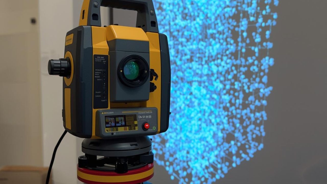
LIDAR measures distances by illuminating targets with laser pulses and analyzing reflected light. Utility applications rely on airborne or ground-based systems that generate three-dimensional point clouds representing terrain, vegetation, and infrastructure with centimeter-level precision.
Solid-State LIDAR holds 35% market share and offers compact form factors suitable for drone integration. FMCW LIDAR captures 28% of the market by providing velocity measurement capabilities alongside distance data. Mechanical LIDAR systems maintain 22% market share through proven 360-degree scanning performance. Hybrid LIDAR solutions account for the remaining 15% by combining multiple sensor technologies.
FMCW systems use Frequency-Modulated Continuous Wave technology to detect both distance and velocity simultaneously. This dual capability proves valuable for monitoring dynamic conditions along transmission corridors. Entry-level UAV LIDAR systems cost $20,000 to $50,000, while premium airborne platforms range from $150,000 to $500,0,00 depending on accuracy specifications.
California's regulatory framework establishes specific requirements for LIDAR regulatory support. CEQA establishes baseline documentation requirements for environmental impact assessments across all major infrastructure projects. The California Public Utilities Commission enforces vegetation clearance standards and wildfire mitigation requirements specific to electric transmission and distribution systems. NERC FAC-003-4 mandates minimum vegetation clearance distances for high-voltage transmission lines to maintain grid reliability.
These regulations require periodic surveys documenting vegetation height, growth rates, and proximity to energized conductors. LIDAR provides the spatial accuracy needed to demonstrate compliance without labor-intensive manual measurements. The technology generates defensible records acceptable to regulatory agencies during audits.
PLS-CADD software converts LIDAR point clouds into engineering models used for clearance analysis and compliance verification. This industry-standard platform processes three-dimensional environmental data to calculate exact distances between conductors and vegetation under various loading conditions. Utilities submit PLS-CADD reports directly to regulators as proof of adequate clearance maintenance.
AI processing of LIDAR data automates vegetation encroachment detection by identifying growth patterns that will violate clearance requirements before physical contact occurs. Machine learning algorithms trained on historical point cloud data predict future encroachment timing with sufficient accuracy for proactive trimming schedules.
Regulatory compliance drives 28% of decision-making weight when California utilities evaluate LIDAR investments. The combination of strict state environmental standards and federal reliability requirements creates unavoidable monitoring obligations that LIDAR satisfies more efficiently than alternatives. Accuracy and performance considerations account for 25% of purchase decisions, reflecting the technical precision required for defensible compliance documentation. Cost and ROI factors influence 22% of procurement decisions despite LIDAR's premium pricing.
California's wildfire prevention mandates impose vegetation management requirements exceeding federal NERC standards in high-risk areas. CPUC regulations require enhanced clearance distances and accelerated inspection cycles that make manual surveying economically impractical. LIDAR enables utilities to meet these elevated standards while controlling inspection costs.
State environmental review processes demand detailed baseline studies and ongoing impact monitoring for transmission line construction and maintenance projects. LIDAR data satisfies CEQA documentation requirements more comprehensively than traditional survey methods. Regulatory agencies increasingly expect three-dimensional spatial analysis rather than two-dimensional mapping.
Accuracy and performance considerations drive 25% of purchase decisions because regulatory compliance depends on measurement precision. Utilities require systems capable of detecting vegetation within inches of conductor surfaces across miles of transmission corridors. Survey-grade accuracy ensures clearance calculations withstand regulatory scrutiny.
Cost and ROI analysis accounts for 22% of decision weight as utilities balance upfront equipment investments against long-term operational savings. LIDAR systems priced between $50,000 and $150,000 must demonstrate clear advantages over $1,500 to $5,000 per-mile helicopter survey costs. Three-year ROI projections ranging from 130% to 360% justify the capital expenditure.
Choose drone-based LIDAR when you need rapid deployment across linear transmission corridors. Drone systems complete projects in 1-3 days, covering 100-1,000 acres per deployment cycle at costs ranging from $1,500 to $5,000 per mile. This approach reduces survey expenses by 30% to 50% compared to manned aircraft and works best for routine compliance monitoring along established rights-of-way.
Choose terrestrial LIDAR when accuracy requirements exceed drone capabilities or when urban infrastructure demands detailed pole-level documentation. Ground-based systems cost $5,000 to $10,000 per mile but provide superior precision for complex environments. These methods achieve 5-50 miles daily coverage and integrate naturally with surveying workflows requiring measurements around existing structures.
Choose helicopter-based LIDAR when you need statewide assessment or rapid coverage following major weather events. Helicopter platforms deliver 100-500 miles daily at costs ranging from $50,000 to $150,000 per survey. The premium pricing justifies itself when time constraints demand immediate network-wide documentation.
California utilities achieve 58% LIDAR adoption rates compared to the 45% North American average. State-specific regulatory pressures and wildfire liability exposure accelerate technology deployment beyond national trends.
Urban utility operations show 72% adoption among large providers due to complex infrastructure density and strict local permitting requirements. Rural service territories demonstrate 48% adoption as utilities balance equipment costs against lower population density. Drone-based systems expanding at 20% annually make rural deployment increasingly economical.
The global LIDAR market reached $3.01 billion to $3.27 billion in 2025 and projects growth to $10.36 billion to $12.79 billion by 2030. Utility companies represent over 41% of LIDAR power line monitoring demand, establishing electrical infrastructure as the dominant application segment. This concentration reflects the critical role of LIDAR regulatory support in maintaining grid reliability and environmental compliance.
LIDAR hardware costs decreased 90% since 2015 through manufacturing improvements and automotive sector volume production. Professional survey-grade systems retain premium pricing due to accuracy requirements and environmental durability specifications.
Mid-range survey LIDAR systems cost $50,000 to $150,000 and provide the accuracy specifications required for utility project regulations. These platforms integrate with aerial mapping workflows to document existing conditions before construction activities begin. Hardware selection depends on coverage requirements, accuracy tolerances, and deployment platform compatibility.
Premium airborne and terrestrial systems priced above $150,000 deliver sub-centimeter accuracy for applications demanding maximum precision. Utilities deploy these systems for critical infrastructure documentation and baseline environmental surveys supporting major transmission projects.
Environmental monitoring software holds approximately 30% of the $14.4 billion to $15.33 billion monitoring market. Compliance software platforms growing at 12.67% CAGR will reach $74.12 billion by 2031 as regulatory complexity increases. These systems process LIDAR point clouds into standardized reports satisfying agency documentation requirements.
Mobile LIDAR mapping integrates with compliance platforms to provide continuous corridor monitoring capabilities. Software tools automate clearance calculations and flag potential violations before they trigger regulatory enforcement.
Vegetation management platforms process LIDAR data to identify encroachment risks months before physical contact occurs. These specialized systems account for tree species growth rates and seasonal variations when predicting future clearance violations. Survey costs ranging from $1,500 to $5,000 per mile provide economic justification compared to manual inspection labor.
Approximately 74% of energy and utility companies have implemented or are actively exploring AI integration for operational monitoring. Machine learning algorithms trained on historical LIDAR datasets achieve detection accuracy exceeding human visual inspection. Terrestrial laser scanning supplements aerial surveys for detailed substation and pole-level documentation.
Deployment method selection balances coverage requirements, timeline constraints, and budget limitations. Drone-based systems complete projects in 1-3 days, covering 100-1,000 acres per deployment cycle. Terrestrial approaches require 2-5 days but achieve 5-50 miles daily along linear corridors.
Helicopter platforms deliver rapid coverage spanning 100-500 miles daily at costs ranging from $50,000 to $150,000 per survey. Each method serves distinct utility project regulations compliance scenarios based on infrastructure type and geographic conditions.
Drone-based LIDAR costs $1,500 to $5,000 per mile and reduces survey expenses by 30% to 50% compared to manned aircraft. UAV platforms excel at transmission corridor surveys where linear coverage patterns optimize flight efficiency. Growing adoption at approximately 20% annually reflects the economic advantages of routine compliance monitoring.
Terrestrial and mobile LIDAR systems cost $5,000 to $10,000 per mile but provide superior accuracy for urban infrastructure documentation. These ground-based methods integrate naturally with surveying workflows requiring precise measurements around existing structures. Helicopter-based surveys justify premium pricing when rapid statewide assessment becomes necessary after major weather events.
Hybrid monitoring strategies reduce vegetation management costs by 60% to 80% through selective LIDAR deployment. Continuous satellite imagery identifies corridor segments experiencing rapid vegetation growth requiring detailed laser scanning. This targeted approach concentrates expensive LIDAR resources on high-risk areas while satellite data monitors the entire network.
Budget-constrained utilities adopt hybrid workflows to maintain compliance without comprehensive annual LIDAR surveys. The combination provides continuous monitoring coverage at costs approaching conventional inspection programs.
Utility LIDAR surveys costing $1,500 to $5,000 per mile compete favorably against manual inspection labor when accounting for data quality and repeatability. Coverage requirements dictate technology selection with drone systems optimizing linear corridor applications. Large-scale network assessments justify helicopter deployment despite higher per-mile costs.
Use case analysis considers regulatory reporting frequency, terrain accessibility, and infrastructure complexity when evaluating deployment options. Subsurface 3D mapping requirements may necessitate terrestrial systems providing complete pole structure documentation.
Hesai Technology holds 37% of the global automotive LIDAR market through aggressive volume pricing strategies. Mass-market manufacturers target $500 to $2,000 price points suitable for vehicle integration applications. Professional surveying segments maintain premium positioning with systems priced above $50,000 based on accuracy specifications.
Valeo produced over 250,000 automotive LIDAR units, demonstrating manufacturing scale economies. Specialized utility providers like YellowScan and ROCK Robotic focus on modular drone-compatible systems priced between $25,000 and $150,000.
Sick AG and Teledyne Optech dominate professional surveying markets with premium systems exceeding $100,000. These manufacturers emphasize measurement precision and environmental durability over cost optimization. Geographic concentration in Europe and North America reflects mature infrastructure monitoring markets.
Chinese manufacturers lead automotive segments through cost-competitive positioning and domestic market scale. California utilities primarily source from specialized surveying equipment providers emphasizing regulatory compliance features.
LIDAR hardware costs have declined 90% since 2015 as solid-state components replaced mechanical scanning mechanisms. Technology maturity enables reliable performance from lower-cost components suitable for high-volume production. Survey-grade systems maintain premium pricing due to calibration requirements and accuracy verification processes.
Component standardization across automotive and industrial applications drives continued cost reduction in core laser ranging technology. Utility-specific features including vegetation penetration capabilities and PLS-CADD integration, justify price premiums above consumer-grade systems.
Entry-level UAV LIDAR systems priced $20,000 to $50,000 serve utilities requiring basic vegetation monitoring capabilities. Mid-range survey platforms costing $50,000 to $150,000 provide the accuracy levels demanded by California environmental compliance programs. Premium systems exceeding $150,000 target applications requiring absolute measurement certainty for regulatory documentation.
Mass-market automotive LIDAR optimizes manufacturing cost over survey accuracy, making these systems unsuitable for utility compliance applications. Specialized providers maintain market positions through industry-specific software integration and regulatory reporting features.
FirstEnergy reduced manual patrols by up to 50% after deploying helicopter-based LIDAR across 7,100 miles of high-voltage transmission lines. The utility created highly accurate three-dimensional corridor maps, enabling proactive vegetation management before encroachment violations occurred. NERC FAC-003-4 compliance documentation improved through defensible spatial data, replacing subjective visual assessments.
The City of San Rafael achieved 25% upfront cost savings and 50% faster project delivery using LIDAR for municipal infrastructure planning. Project completion timelines were shortened from 6.25 months to 3 months through the elimination of iterative site visits.
ROCK Robotic and Surefire Consulting deployed DJI M300 RTK drones with R2A LIDAR systems for California power line inspection in challenging terrain. The approach eliminated expensive helicopter surveys while capturing error-free point cloud data suitable for immediate compliance verification. PLS-CADD formatted deliverables are integrated directly into utility engineering workflows without data conversion delays.
FirstEnergy's implementation demonstrated a vegetation management program transformation through comprehensive corridor documentation. The utility identified encroachment risks months before they would trigger regulatory violations or service interruptions.
Utility LIDAR investments yield a projected ROI of 130% to 360% over 3 years through operational cost reduction and outage prevention. Initial investments ranging from $500,000 to $1,500,000 generate annual benefits between $3.45 million and $6.9 million. Payback periods of 1.5 to 2.5 years prove acceptable for utilities managing regulatory compliance obligations.
Cost-benefit analysis accounts for avoided regulatory penalties, reduced inspection labor, and prevented outage costs when calculating LIDAR program value. San Rafael's 25% upfront savings and 50% timeline compression demonstrate quantifiable benefits beyond vegetation management applications. Technology investments supporting projects across multiple infrastructure categories amplify ROI calculations.
Successful implementations emphasize data management infrastructure capable of processing and storing massive point cloud datasets. Utilities underestimating storage requirements encounter workflow bottlenecks that diminish LIDAR program effectiveness. Integration planning with existing GIS and asset management systems proves critical for long-term value realization.
Training investments ensuring staff competency with LIDAR analysis software, determine whether utilities capture available efficiency gains. Organizations treating LIDAR as a simple survey tool replacement miss opportunities for predictive maintenance and advanced analytics.
AI automation of vegetation encroachment detection eliminates manual point cloud analysis for routine compliance monitoring. Machine learning algorithms identify trees approaching clearance violations with accuracy exceeding human visual inspection. Approximately 90% of organizations using AI have deployed generative tools for compliance reporting and documentation tasks.
Three-dimensional maps created from LIDAR data enable proactive identification of environmental risks before they trigger regulatory violations. Predictive models trained on historical growth patterns forecast future encroachment timing with sufficient precision for optimized maintenance scheduling. AI integration transforms the future of utility locating from reactive problem response to predictive risk management.
Automated detection systems process LIDAR point clouds to flag vegetation segments exceeding growth rate thresholds. AI algorithms account for species-specific growth patterns and seasonal variations when predicting clearance violation timing. This automation eliminates the manual analysis bottleneck previously limiting LIDAR program scalability.
Predictive maintenance scheduling optimizes trimming crew deployment by concentrating resources on the highest-risk corridor segments. Machine learning models improve accuracy over time as they incorporate additional inspection cycles into training datasets.
LIDAR data integration with legacy IT systems enables automated compliance report generation, satisfying regulatory documentation requirements. Software platforms extract required measurements from point clouds and populate standardized reporting templates without manual data entry. This integration reduces reporting cycle time from weeks to days while improving accuracy.
Compliance software maintains audit trails documenting measurement methodology and data processing workflows for regulatory review. Automated systems generate alerts when vegetation conditions approach violation thresholds requiring immediate corrective action.
Emerging AI capabilities will enable real-time processing of LIDAR data during survey flights rather than post-processing workflows. Edge computing platforms mounted on survey drones will identify compliance issues immediately, allowing rapid resurvey of questionable areas. This real-time validation ensures complete data capture before demobilizing equipment from project sites.
Advanced machine learning models will correlate LIDAR vegetation data with weather patterns, soil conditions, and historical growth records to improve long-term encroachment predictions. Multi-sensor fusion combining LIDAR with thermal imaging and multispectral data will detect tree health conditions, indicating accelerated growth or structural instability.
California utilities face increasingly complex environmental compliance demands requiring advanced spatial data solutions. LIDAR technology delivers the precision, efficiency, and regulatory defensibility your infrastructure projects need. At Bess Utility Solutions, we combine survey-grade LIDAR capabilities with deep utility compliance expertise to help you meet CEQA, CPUC, and NERC requirements while controlling costs.
Our team specializes in deploying drone-based, terrestrial, and hybrid LIDAR solutions tailored to your specific regulatory obligations and infrastructure characteristics. We combine advanced survey technology with the advantages of using vacuum excavation to deliver comprehensive infrastructure documentation supporting both environmental compliance and construction safety objectives. Whether you need vegetation management programs, transmission corridor surveys, or environmental documentation, we provide turnkey solutions that reduce compliance risk and operational costs.
Contact us today to discuss how our LIDAR services can strengthen your environmental compliance program and optimize your utility operations.


