Hayward, CA
Fresno, CA
Orange, CA
Sacramento, CA
Phoenix, AZ
California construction faces unprecedented underground complexity as dense utility networks intersect with aging infrastructure and ambitious capital programs. Professional GPR utility surveys provide survey-grade subsurface data that prevents utility strikes, reduces redesign, and protects project schedules across transportation, commercial development, and public infrastructure sectors.
Key Takeaways
Ground-penetrating radar delivers non-destructive detection of both metallic and non-metallic utilities before excavation begins. Combining GPR with electromagnetic locating and selective vacuum excavation creates the multi-sensor approach recommended by federal highway guidance, reducing the costly surprises that derail California projects.
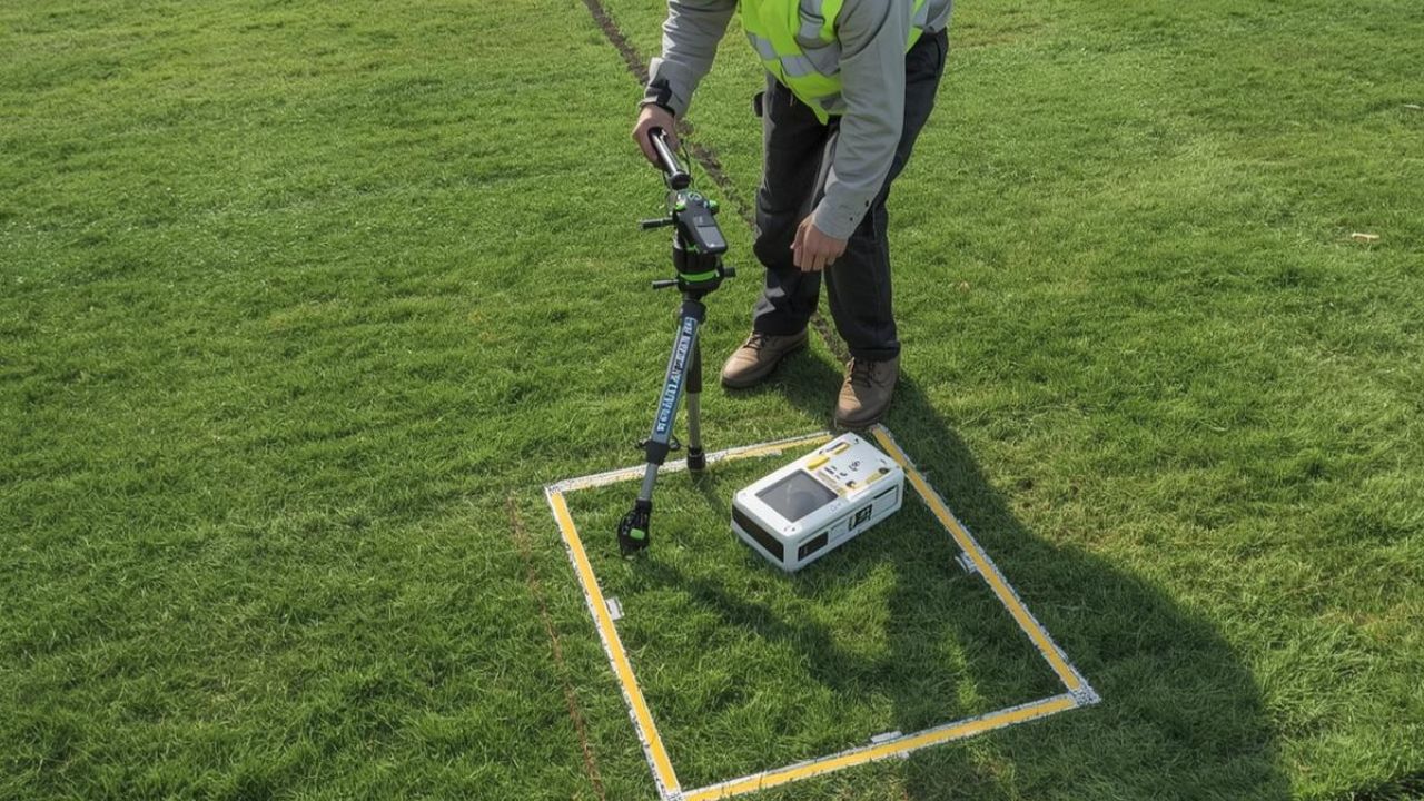
Ground-penetrating radar transmits high-frequency electromagnetic pulses into the ground and records reflections from subsurface interfaces. These reflections reveal the location, depth, and characteristics of buried utilities, voids, and other features without excavation.
Professional GPR utility surveys integrate this technology with survey control, records review, and electromagnetic methods to deliver defensible mapping. Utility detection accounted for 24.25% of the global GPR market in 2025, reflecting widespread adoption in construction and infrastructure sectors.
GPR equipment sends radar waves through soil, concrete, or pavement and measures the time and strength of returning signals. Different materials produce distinct reflection signatures, allowing trained operators to distinguish utilities from natural features and map their positions.
California's construction contribution to GDP reaches USD 160 billion, creating a strong economic incentive for accurate subsurface investigation. Professional surveying workflows deliver higher confidence than basic compliance-only marking, supporting design decisions and excavation planning.
Professional workflows combine multiple investigation methods rather than relying on GPR alone. The Federal Highway Administration recommends a multi-sensor approach for transportation corridor mapping that includes records review, survey control establishment, GPR scanning, and electromagnetic locating.
Single-channel GPR offers flexibility and efficiency for routine utility surveys on smaller sites. Multi-channel systems improve productivity in corridor environments but require stronger processing expertise and higher mobilization investment.
Subsurface utility engineering combines civil engineering, surveying, and geophysics to manage underground risk throughout project delivery. SUE workflows help avoid unnecessary utility relocations, redesign, contractor claims, and safety incidents through systematic investigation and documentation.
ASCE 38-compliant SUE differs from narrower private locating services through stronger deliverables, survey integration, and quality-level definitions. QL-A vacuum excavation provides the highest confidence through direct visual confirmation, while professional GPR utility surveys serve preconstruction detection, design verification, and routine utility-conflict screening.
California projects operate under extraordinary funding pressure, dense utility conditions, and strict safety expectations. Accurate subsurface investigation protects schedules and budgets when underground conflicts can trigger expensive redesign, relocation, and delay.
Federal and state infrastructure programs totaling USD 109.1 billion since 2021, plus USD 26.4 billion in voter-approved bonds, expand the pool of complex projects requiring high-confidence utility mapping. Building and construction represented 28.53% of the end-user share in the underground utility mapping market in 2025.
California combines USD 86 billion in private nonresidential and state-local construction activity with massive public infrastructure investment. This concentration creates demand for technologies that reduce the costly utility surprises common on major corridor and transit programs.
Transportation, water, and urban redevelopment projects face heightened underground risk because legacy utility records often contain gaps or inaccuracies. Professional utility locating helps reduce project delays by revealing conflicts before design lock-in or excavation mobilization.
Professional locators rated their own accuracy at 9.6 out of 10, safety at 9.3, and on-time performance at 9.1 in industry research. These performance dimensions reflect buyer priorities when underground consequences are serious enough to justify a higher-standard investigation.
Strong SUE workflows deliver a 40.33% reduction in project relocation costs and USD 11.39 in savings for every dollar spent on accurate mapping. Delay reduction reaches 9.08%, while redesign costs fall 9.59% when projects adopt compliant subsurface investigation practices.
Los Angeles Metro operates a USD 26.8 billion capital program spanning rail, bus rapid transit, highway, and active transportation projects. Caltrans has invested in 3D utility data repositories to improve design accuracy and reduce relocation surprises on state highway corridors.
The San Francisco Bay Area, Sacramento, and Central Valley regions also maintain significant public works and commercial development activity. Demand concentrates where dense underground conditions intersect with aging infrastructure, transit expansion, and urban infill development.
Underground surprises remain a leading source of construction delays, cost overruns, and contractor claims across California. Poor subsurface understanding forces unnecessary relocations, triggers mid-project redesign, and creates unexpected conditions that derail schedules.
Professional GPR utility surveys reduce these risks by revealing utility conflicts before excavation begins. Accurate mapping supports relocation planning, design verification, and excavation sequencing, preventing the costly stoppages that occur when crews encounter unmarked or mislocated infrastructure.
Incomplete or inaccurate utility records force design teams to assume infrastructure locations, creating conflict risk when construction begins. Unnecessary relocations occur when projects move utilities that could have been avoided through better subsurface understanding.
One California High-Speed Rail phase attributed USD 400 million in additional costs to utility relocations complicated by insufficient infrastructure knowledge. Contractor claims from differing site conditions increase when subsurface investigations fail to reveal existing utilities or underground obstructions.
More than 20% of annual buried infrastructure damages stem from locating issues rather than excavator negligence or carelessness. Excavation contractors reported that 73% identified weaknesses in the 811 process, with 78% naming inaccurate locating as the biggest problem.
GPR technology improves safety in excavation and construction by detecting utilities that traditional electromagnetic methods miss. Non-metallic lines, abandoned infrastructure, and assets without tracer wire require GPR scanning to avoid dangerous strikes during trenching, boring, or drilling.
Utility strikes force work stoppages while emergency repairs occur and regulatory investigations proceed. Labor crews remain idle during conflict resolution, adding direct cost while delaying subsequent activities across the critical path.
Professional utility surveys identify conflicts during preconstruction planning when alternative alignments or sequencing adjustments remain feasible. Early detection prevents the compressed decision-making and expensive workarounds that occur when crews encounter unexpected infrastructure in active excavation zones.
California's diverse construction landscape creates demand across multiple GPR application categories. Professional utility surveys dominate the market because they serve preconstruction detection, design verification, and routine conflict screening across project types.
Utility relocation support represents the second-largest revenue pool, driven by corridor upgrades where relocation planning errors produce outsized budget impacts. Commercial development scanning, transportation corridor mapping, and concrete structural scanning address more specialized needs.
Preconstruction surveys reveal utility conflicts before design teams commit to final alignments, foundation locations, or grading plans. Design-phase verification confirms that proposed improvements avoid existing infrastructure or identify necessary relocations with sufficient lead time.
Construction-phase scanning supports trenching, boring, and foundation work by confirming utility-free zones or detecting unmarked lines. Understanding the importance of utility locating in construction projects helps buyers select appropriate investigation scope and quality levels for each delivery phase.
Major corridor projects require systematic relocation planning to control costs and maintain schedule certainty. California-relevant corridor work involving 36 rail grade crossings over 10 miles demonstrates the complexity of managing existing utilities during infrastructure expansion.
High-speed rail programs, transit extensions, and highway widening projects face extraordinary relocation exposure when subsurface conditions remain uncertain. Professional GPR utility surveys provide the location confidence needed to sequence relocations, avoid dry holes, and prevent redesign during construction.
Urban infill, industrial facilities, healthcare campuses, and data centers require accurate utility mapping to support site planning and foundation design. Dense utility conditions in developed areas create conflict risk when developers rely solely on outdated record drawings.
Professional scanning reveals existing infrastructure that affects grading, drainage, building placement, and utility service routing. Early detection supports entitlement planning, reduces change orders, and prevents the excavation surprises that delay commercial project delivery.
California buyers prioritize accuracy, safety, and schedule certainty over the lowest upfront cost when underground risk threatens project delivery. Excavation contractors identified inaccurate locating as their biggest complaint, cited by 78% of respondents reporting weaknesses in standard 811 processes.
Professional SUE-grade mapping represents approximately 1.65% of project budgets but delivers 29.46% reduction in construction and design costs. This asymmetry between survey cost and consequence cost drives purchase decisions when underground conflicts can trigger expensive redesign or relocation.
Locators rated accuracy at 9.6 out of 10 and safety at 9.3, reflecting professional understanding that precision matters more than speed alone. Stakeholder research shows buyers want location tolerances better than 100 millimeters to depths of 3 to 5 meters, exceeding what basic compliance marking delivers.
Project managers and construction superintendents recognize that inaccurate subsurface data creates liability exposure, derails schedules, and forces reactive decision-making. Professional surveying protects budgets by preventing the strikes, relocations, and redesigns that occur when investigation quality falls short.
Some buyers hesitate over upfront GPR costs when they overestimate the reliability of 811 locating or legacy record drawings. Soil conditions affect GPR accuracy, particularly in clay-heavy or highly conductive environments where electromagnetic methods may perform better.
Interpretation quality varies significantly across providers, making vendor selection critical to achieving defensible results. Depth confidence may require QL-A vacuum excavation at critical conflict points, adding cost but eliminating the uncertainty that leads to expensive construction-phase surprises.
Budget-tier services range from USD 800 to USD 1,500 per day for small, well-defined scans with paint or flag marks and simple field notes. Mid-range offerings cost USD 1,500 to USD 3,000 per day, delivering standard utility surveys with mark-outs, summary reports, and basic CAD or GIS outputs.
Premium services reach USD 3,000 to USD 5,000 per day for dense utility environments requiring integrated utility maps, deeper analysis, and survey alignment. Average GPR scanning costs USD 1,000 to USD 5,000 per day, with most providers adding a USD 250 to USD 500 mobilization fee.
Federal highway guidance explicitly recommends multi-sensor workflows rather than relying on GPR alone. Professional investigations combine ground-penetrating radar with electromagnetic locating, survey control, records review, and selective vacuum excavation to maximize accuracy across varying site conditions.
Single-channel GPR offers flexibility and efficiency for routine utility surveys, while multi-channel systems improve corridor productivity through faster data acquisition and richer visualization. Technology selection should begin with required confidence levels and site-condition analysis rather than generic equipment preferences.
Single-channel GPR works well for flexible, relatively efficient scanning that detects non-metallic targets on smaller sites. Multi-channel and 3D GPR systems deliver better corridor productivity, stronger depth and context information, and richer visualization, but require higher cost and larger mobilization.
Integrated SUE workflows provide the best overall decision quality and design usefulness on complex, high-value, delay-sensitive California projects. Advanced GPR technology and innovation continue to improve data capture speed, processing efficiency, and deliverable clarity across application types.
Clay, conductive soils, and high-moisture conditions degrade GPR performance by attenuating radar signals and reducing penetration depth. Multi-channel GPR faces the same soil limitations as single-channel equipment, requiring complementary electromagnetic methods in challenging environments.
Professional providers assess site conditions before mobilization and adjust the technology mix accordingly. Sandy or dry soils support deeper GPR penetration, while conductive conditions favor electromagnetic locating for metallic utilities or assets with tracer wire.
Electromagnetic and time-domain electromagnetic locating methods perform well for metallic utilities and tracer-wire conditions, working better in conductive soils than GPR. EM techniques prove less effective for non-metallic targets or unknown assets without a traceable signal.
QL-A vacuum excavation provides the highest confidence through direct visual confirmation at critical conflict points. Combining GPR, EM locating, survey integration, and selective potholing creates the defensible multi-sensor approach that protects California construction budgets and schedules.
Professional utility mapping delivers USD 11.39 in savings for every USD 1 spent on accurate subsurface investigation. This return stems from avoided utility strikes, reduced relocation costs, lower redesign expenses, and shorter project delays.
Strong SUE workflows reduce project delays by 9.08%, redesign costs by 9.59%, and combined construction and design costs by 29.46%. Early utility mapping prevents the compressed decision-making and expensive workarounds that occur when crews encounter unexpected infrastructure during active excavation.
Comparative studies of SUE-compliant versus non-compliant highway projects document measurable improvements across multiple cost categories. Relocation costs fall 40.33% when accurate mapping reveals conflict-free alignments or identifies necessary moves early enough for efficient sequencing.
The 9.08% delay reduction reflects faster construction execution when crews avoid utility strikes and unplanned work stoppages. Professional surveying protects schedules by eliminating the emergency repairs, regulatory investigations, and redesign cycles that follow subsurface surprises.
Utility relocations represent one of the largest underground cost exposures on major California infrastructure projects. One high-speed rail phase attributed USD 400 million in additional costs to relocation complications stemming from insufficient subsurface understanding.
Early detection through professional GPR utility surveys allows design teams to optimize alignments around existing infrastructure or plan relocations with adequate lead time. This proactive approach prevents the rushed, expensive relocations that occur when conflicts surface during construction mobilization.
California's construction and infrastructure GPR market reached an estimated USD 14.8 million in 2025. Five-year projections point toward USD 20.9 million by 2030, implying approximately 7.2% compound annual growth.
The broader U.S. GPR market was USD 173.67 million in 2024 and USD 185.9 million in 2025. Projections reach USD 367.13 million by 2035 at 7.04% CAGR, driven by transportation infrastructure investment, building construction activity, and adoption of digital utility records.
California's USD 109.1 billion infrastructure pipeline creates sustained demand for technologies that reduce underground risk. Federal highway guidance, state GIS-mapping requirements, and Caltrans utility-data programs all reinforce the movement toward higher-quality subsurface investigation.
Buyers increasingly recognize that accurate utility mapping protects project budgets more effectively than reactive approaches that defer investigation until excavation begins. Professional GPR utility surveys deliver the preconstruction certainty needed to avoid redesign, control relocation costs, and maintain schedule adherence.
Professional utility surveys, relocation support, and commercial development scanning represent the three largest California application categories. Transportation corridor mapping grows quickly as public agencies adopt 3D utility repositories and richer design integration.
Technology advances in multi-channel GPR, processing automation, and survey integration continue to improve productivity and deliverable quality. The strongest providers combine equipment capability with interpretation expertise, survey-grade positioning, and multi-sensor workflows that adapt to site-specific soil conditions.
Bess Utility Solutions brings 29 years of experience and ASCE 38-02 compliant processes to California construction projects requiring survey-grade subsurface data. CPUC certification, MBE/DBE status, and regional office coverage across California, Arizona, and Nevada support responsive service delivery on infrastructure and commercial programs.
Professional GPR utility surveys protect California construction schedules by revealing underground conflicts before excavation begins. Accurate subsurface investigation reduces strikes, controls relocation costs, and eliminates the redesign cycles that follow subsurface surprises.
Every day of delay costs money. Every utility strike creates risk. And every missed conflict in the design phase becomes an expensive problem on-site.
Bess Utility Solutions delivers survey-grade GPR utility surveys across California and Arizona — backed by 29 years of field experience, ASCE 38-02 compliant processes, and CPUC certification. Our multi-sensor approach combines ground-penetrating radar, electromagnetic locating, and vacuum excavation to give your team the subsurface accuracy needed to keep projects on schedule and within budget.
With regional offices across California and a track record of 1,000+ satisfied clients, we provide the responsive, reliable service that project managers, superintendents, and engineers count on when the stakes are high.
Request a consultation today and build your next California project on a foundation of certainty. Contact Bess Utility Solutions today!
Disclaimer:
Every utility project is unique, and pricing can vary depending on location, complexity, and service needs. The prices mentioned are estimates only. For the most accurate and competitive quote, we recommend contacting Bess Utility Solutions for a personalized assessment.


