Hayward, CA
Fresno, CA
Orange, CA
Sacramento, CA
Phoenix, AZ
California utility companies face extreme wildfire risk and strict regulatory oversight that demand precise infrastructure monitoring. Light Detection and Ranging technology addresses these challenges by delivering accurate vegetation mapping and asset condition data.
LIDAR-based aerial mapping inspection systems enable utilities to identify hazards before they cause outages or ignitions. This technology supports California utility asset management programs by reducing inspection cycles and improving safety outcomes.
Key Takeaways
LIDAR is a Light Detection and Ranging technology that measures distances using laser pulses. The system creates detailed point clouds showing power lines, poles, and surrounding vegetation structures. LIDAR maintenance tools can reduce inspection time by up to 70% compared to traditional methods.
The global LIDAR market was valued at USD 2.74 billion in 2024 and is projected to reach USD 4.71 billion by 2030. This growth reflects increasing adoption across utility monitoring applications worldwide.
LIDAR systems emit laser pulses that reflect off surfaces to create three-dimensional models. These models provide centimeter-level accuracy for measuring clearances between conductors and vegetation.
North American LIDAR market growth demonstrates rapid industry adoption, projected to increase from USD 1.25 billion in 2025 to USD 4.8 billion by 2030. LIDAR systems currently hold 25% market share in utility asset inspection technologies.
Choose LIDAR if you need subsurface vegetation penetration and precise clearance measurements in areas with dense tree canopies. LIDAR works effectively regardless of lighting conditions and delivers engineering-grade spatial data.
Choose photogrammetry when visual documentation is the primary requirement and vegetation penetration is not essential. Photogrammetry costs less for simple visual inspections but cannot measure beneath tree canopies.
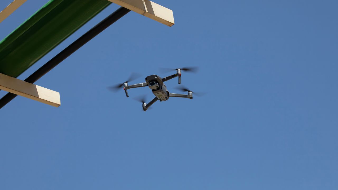
UAVs are unmanned aerial vehicles used for deploying LIDAR sensors across utility corridors. Rotary-wing drones dominated the inspection market with 64.58% market share due to maneuverability advantages.
Southern California Edison launched a helicopter-mounted LIDAR program in 2023 to survey vegetation across its service area. Surefire Consulting used a DJI M300 RTK drone with ROCK R2A LIDAR for power line inspection.
Choose helicopter-mounted LIDAR when covering extensive transmission corridors spanning hundreds of miles. Helicopters deliver faster coverage rates for large-scale surveys across difficult terrain.
Choose drone-based LIDAR for localized inspections, complex terrain access, and projects requiring lower operational costs. Drones provide superior maneuverability in confined spaces and enable close-proximity data collection.
Manual inspections account for approximately 35% of the overall market share despite higher costs and safety risks. Thermal imaging represents 18% market share, while sensor networks and IoT represent 12%.
Drone photogrammetry cannot penetrate vegetation to measure conductor clearances beneath tree canopies. Photogrammetry is lighting dependent and cannot function effectively during cloudy conditions or nighttime operations.
Choose manual inspection when regulatory compliance requires hands-on verification or when infrastructure access prevents aerial deployment. Manual methods remain necessary for detailed component examination and testing.
Choose LIDAR when data accuracy and comprehensive coverage outweigh budget concerns. LIDAR delivers superior measurement precision and enables proactive vegetation management through detailed spatial analysis.
California utilities face catastrophic wildfire liability that requires comprehensive vegetation management and infrastructure monitoring. Regulatory mandates from the California Public Utilities Commission enforce strict compliance standards for utility monitoring programs.
The state's diverse geography creates inspection challenges ranging from dense urban corridors to remote mountainous terrain. LIDAR technology addresses these conditions while satisfying both operational efficiency and regulatory compliance requirements.
CPUC is the California Public Utilities Commission that oversees investor-owned utility safety and reliability standards. The WERK program is the Wildfire, Ecosystem Resilience, and Risk Assessment program, processing statewide vegetation data.
Regulatory compliance ranked at 91% for California utilities implementing advanced inspection technologies. Wildfire risk mitigation ranked at 89% as utilities prioritize ignition prevention through precise clearance monitoring.
The WERK program processed over 40.5 million hectares of LIDAR data for statewide vegetation assessment. This massive data collection demonstrates California's commitment to wildfire prevention through advanced technology adoption.
California achieved a 75% overall adoption rate for LIDAR technology among major utilities. Northern California shows a 78% LIDAR adoption rate focused on transmission corridor vegetation management.
Southern California exhibits a 72% adoption rate with emphasis on urban infrastructure modeling. Urban utilities show 72% LIDAR adoption rate while rural utilities show only 35% adoption.
Choose LIDAR implementation in Northern California when wildfire risk and transmission corridor monitoring drive your California utility asset management strategy. The terrain characteristics favor aerial LIDAR deployment for vegetation encroachment detection.
Choose urban-focused LIDAR applications in Southern California when infrastructure documentation and distribution system modeling are primary objectives. Urban deployments benefit from shorter survey distances and existing infrastructure access.
Large utilities show 78% adoption rate for drone technologies and 65% adoption rate for LIDAR systems. Small utilities show 68% adoption for manual inspections, with only 18% utilizing LIDAR technology.
Small utilities face budget constraints limiting LIDAR adoption despite proven operational benefits. Initial LIDAR investment ranges from $500,000 to $1,500,000, creating a high initial cost barrier.
Choose in-house LIDAR equipment ownership when inspection frequency exceeds 50 days annually, and the service territory requires continuous monitoring. The payback period of 1.5 to 2.5 years makes ownership financially attractive for large utilities.
Choose service-based LIDAR contracts when inspection needs occur seasonally, or capital budget limitations prevent equipment purchase. Service providers deliver professional-grade results without ownership costs.
Utility companies deploy LIDAR systems to create accurate digital twins of their electrical infrastructure. These models enable precise measurement of vegetation encroachment and structural condition assessment.
Mobile LIDAR mapping provides continuous corridor surveys while airborne systems cover larger service territories efficiently. Data processing workflows convert raw point clouds into actionable maintenance work orders.
SCE manages over 1.6 million trees in its service area, requiring continuous monitoring. SCE's system shows the exact distance between trees and conductors, such as 5 feet or 10 feet.
LIDAR penetrates tree canopies to measure clearances that visual inspections cannot assess accurately. Utilities prioritize high-risk vegetation based on growth rates and proximity to energized conductors.
Choose LIDAR for vegetation management when regulatory requirements demand documented clearance measurements with engineering-grade accuracy. LIDAR provides auditable records showing exact measurements at specific dates for compliance reporting.
Choose traditional inspection methods when a simple visual assessment of obvious hazards is sufficient and detailed measurements are not required. Visual inspections work for initial hazard identification before detailed LIDAR analysis.
Surefire's project involved a 500-foot elevation change over muddy terrain where traditional access proved difficult. The operation surveyed 15 acres efficiently while avoiding utility service disruptions.
Terrestrial laser scanning complements aerial LIDAR by capturing detailed substation and switchyard infrastructure models. Combined datasets enable comprehensive asset management across transmission and distribution systems.
Choose aerial LIDAR when covering extensive linear infrastructure such as transmission corridors spanning multiple miles. Aerial platforms deliver faster coverage and consistent data quality across large service territories.
Choose terrestrial LIDAR scanning for detailed substation documentation, switchyard modeling, and locations where overhead access is restricted. Ground-based systems capture vertical infrastructure and equipment details that aerial platforms cannot reach.
Enterprise Asset Management encompasses utility asset management technologies, including LIDAR data integration platforms. Data management complexity for sensor networks requires standardized processing workflows.
Automated classification algorithms identify conductors, poles, and vegetation from raw point clouds. Analysis software measures clearances and flags conditions requiring field crew attention. Processing times range from hours to days, depending on survey size and required deliverable complexity.
Financial analysis reveals significant cost differences between service-based pricing and in-house equipment ownership. Utilities must evaluate deployment scale and frequency to determine optimal investment strategies.
LIDAR implementation delivers measurable return on investment through reduced inspection costs and improved asset reliability. Surveying mapping accuracy prevents costly emergency repairs by identifying defects during scheduled maintenance windows.
Drone photogrammetry ranges from $1,500 to $3,000 for small sites, while LIDAR services start at $3,000. LIDAR services cost $150-$300 per acre for large-scale surveys covering 500+ acres.
Daily rates for drone LIDAR services range from $6,500 to $9,000, with premium requirements reaching $12,000. Base LIDAR equipment costs $50,000-$150,000 while mobile mounting systems add $15,000-$25,000.
Choose service-based LIDAR when annual inspection requirements total fewer than 30 days or when specialized expertise is required for complex projects. Service providers eliminate equipment maintenance costs and staffing requirements.
Choose equipment ownership when inspection frequency exceeds 50 days annually and in-house expertise is available for sensor operation and data processing. Ownership provides scheduling flexibility and eliminates daily service rates.
Drone-based inspections can reduce inspection costs by 40% to 60% compared to traditional methods. LIDAR implementation delivers 130% to 360% ROI within three years.
The payback period of 1.5 to 2.5 years for LIDAR implementation makes adoption financially attractive. Up to 65% cost reduction occurs when transitioning from manual to drone services.
Manual pipeline inspection costs $100,000 annually, while drone services cost $35,000-$50,000, representing significant operational savings. These cost reductions enable utilities to increase inspection frequency without proportional budget increases.
Small utilities struggle to justify capital expenditure for infrequent inspection needs across dispersed service territories. Rural cooperatives face limited budgets that prioritize immediate operational needs over technology investments.
Service-based pricing models enable smaller utilities to access LIDAR capabilities without ownership costs. Shared service agreements and regional partnerships distribute investment across multiple utility providers.
Choose shared service agreements when multiple small utilities operate in adjacent service territories. Collective procurement reduces per-utility costs while delivering professional-grade LIDAR capabilities.
Choose grant funding and regulatory cost recovery when available to offset LIDAR implementation costs. California's regulatory framework allows utilities to recover vegetation management technology investments through rate cases.
Technology selection depends on inspection objectives, terrain characteristics, and budget constraints. Utilities combine multiple technologies to address different asset classes and monitoring requirements.
Market segmentation reflects varying capabilities and cost structures across inspection methods. Data accuracy requirements drive technology selection for California utility asset management programs.
The drone inspection and maintenance market, valued at USD 8.43 billion in 2025 projects to surge to USD 35.35 billion by 2034. The EAM market is projected to grow from USD 5.87 billion in 2025 to USD 9.02 billion by 2030.
The Utility Asset Management sector, valued at USD 5.35 billion in 2025, is expected to reach USD 9.81 billion by 2034. North America leads the utility asset management market with 32.06% share in 2025.
Choose LIDAR for applications requiring precise spatial measurements and vegetation penetration capabilities. LIDAR excels at transmission corridor vegetation management and clearance documentation.
Choose IoT sensors for continuous real-time monitoring of specific asset conditions such as conductor temperature or line sag. IoT provides ongoing data streams rather than periodic survey snapshots.
Choose photogrammetry when visual documentation is the primary objective and budget constraints limit LIDAR deployment. Photogrammetry delivers lower-cost visual records suitable for general inspection purposes.
Manual inspection has safety risks and time constraints, limiting scalability across extensive infrastructure networks. Limited scale for manual inspection methods prevents comprehensive system-wide assessments.
Weather dependency for LIDAR operations restricts flight windows during precipitation or high wind conditions. High infrastructure cost for IoT systems requires ongoing maintenance and network connectivity investments. Pilot expertise required for operations adds training and certification costs to drone programs.
Large investor-owned utilities benefit from in-house LIDAR capabilities supporting continuous vegetation management programs. Municipal utilities and cooperatives prefer service-based models matching seasonal inspection cycles.
Industrial facilities and military installations require subsurface 3D mapping combining LIDAR with ground-penetrating radar for comprehensive infrastructure documentation. Urban utilities prioritize photogrammetry for visual documentation alongside LIDAR for technical measurements.
Choose in-house capabilities when your utility conducts more than 50 inspection days annually and maintains qualified technical staff. Ownership delivers operational flexibility and eliminates service provider scheduling dependencies.
Choose service contracts when inspection needs are seasonal, specialized expertise is required, or capital budgets restrict equipment purchases. Service providers deliver turnkey solutions without ongoing maintenance obligations.
Utilities evaluate multiple criteria when selecting asset management technologies for infrastructure monitoring programs. Decision frameworks balance immediate operational needs against long-term strategic asset management objectives.
Cost efficiency and safety remain paramount while regulatory compliance drives technology adoption timelines. Speed and data accuracy determine operational effectiveness and regulatory reporting capabilities.
95% of utilities rank cost efficiency as a top priority when evaluating asset management technologies. Safety ranked as a critical factor by 93% of utilities implementing remote sensing programs.
LIDAR eliminates worker exposure to energized equipment and hazardous terrain during inspection activities. Cost reduction from automated inspections enables reinvestment in grid modernization and resilience improvements.
Choose LIDAR when safety concerns justify a higher initial investment to eliminate personnel exposure to high-risk inspection environments. The risk reduction delivers long-term liability protection and workforce safety improvements.
Choose manual inspection when regulatory requirements mandate hands-on verification or when specific asset conditions require tactile assessment. Some inspection protocols still require physical interaction despite available remote sensing alternatives.
Speed is ranked as important by 88% of utilities facing compressed inspection cycles and regulatory deadlines. Accuracy is ranked important by 87% of utilities requiring engineering-grade measurements for compliance documentation.
California utilities must demonstrate compliance with CPUC vegetation management standards through accurate clearance documentation. LIDAR provides auditable records showing exact measurements at specific dates for regulatory reporting.
Choose LIDAR when regulatory compliance requires documented measurements with engineering-grade accuracy and defensible audit trails. Data accuracy and timestamped records satisfy regulatory reporting requirements.
Choose visual inspection methods when general condition assessment is sufficient and precise measurements are not required for compliance. Visual inspections work for preliminary hazard identification before detailed analysis.
LIDAR reduces outage risk by identifying structural defects and vegetation hazards before failure occurs. Predictive maintenance programs use LIDAR data to prioritize capital investments across aging infrastructure.
Insurance carriers recognize risk reduction from comprehensive inspection programs when calculating utility liability premiums. Wildfire mitigation plans incorporating LIDAR surveillance demonstrate proactive safety management to regulators and stakeholders.
Choose comprehensive LIDAR programs when wildfire liability exposure justifies investment in advanced monitoring capabilities. LIDAR documentation provides defensible evidence of proactive vegetation management.
Choose basic inspection programs when wildfire risk is minimal and regulatory requirements permit less stringent monitoring protocols. Not all utilities face equivalent risk profiles requiring maximum monitoring investment.
California's three major investor-owned utilities demonstrate different implementation strategies matching their service territory characteristics. These case studies illustrate practical applications and operational benefits across diverse deployment scenarios.
Real-world implementations provide valuable insights into technology integration and workflow development. Successful programs combine LIDAR technology with existing asset management systems and field operations.
Southern California Edison launched a comprehensive helicopter-mounted LIDAR program in 2023, addressing wildfire risk. SCE Advisor Arthur Torres describes the system functioning like sonar but using light pulses instead of acoustics.
The program creates precise models showing exact distances between trees and conductors throughout the service area. Locating PG&E gas transmission infrastructure demonstrates similar precision requirements for subsurface utility corridors. This implementation shows how large utilities apply aerial LIDAR for vegetation management at scale.
Surefire Consulting utilized a DJI M300 RTK drone with ROCK R2A LIDAR for power line inspection. The project addressed challenging 500-foot elevation changes over muddy terrain in California's north coastal region.
Surefire eliminated expensive helicopter scans while avoiding utility disruptions during the inspection process. The operation delivered PLS-CADD models meeting engineering standards for transmission line design and clearance analysis.
This case demonstrates drone LIDAR effectiveness for localized inspections in difficult terrain where traditional access proves impractical.
PG&E integrated drones into its system inspection program through Project EPIC 3.41, focusing on automation. The initiative combines drone platforms with computer vision and machine learning for equipment anomaly detection.
Automated flight planning and inspection workflows detect defects before they result in outages or fires. PG&E Fresno Belt Main projects demonstrate utility commitment to advanced infrastructure documentation and monitoring. This implementation shows how LIDAR integrates with artificial intelligence for comprehensive utility monitoring.
LIDAR technology represents the foundation for next-generation utility asset management systems in California. Integration with artificial intelligence and machine learning enables predictive analytics that transform reactive maintenance into proactive risk mitigation.
California utilities will continue expanding LIDAR adoption as costs decrease and regulatory requirements intensify. The transition from manual inspections to automated sensing represents a fundamental shift in utility operations.
LIDAR data accuracy enables utilities to demonstrate regulatory compliance while optimizing vegetation management investments across vast service territories. The future of utility locating AI drones and smart mapping demonstrates convergence between aerial and subsurface infrastructure documentation technologies.
LIDAR technology transforms California utility asset management through precise vegetation monitoring, comprehensive infrastructure documentation, and regulatory compliance support. The data accuracy and operational efficiency LIDAR delivers make it essential for utilities facing wildfire risk and strict CPUC oversight.
At Bess Utility Solutions, we deliver survey-grade LIDAR capabilities specifically designed for California utility infrastructure projects. Our team combines advanced aerial mapping technology with deep utility industry expertise to support your vegetation management and asset monitoring programs.
Contact us today to discover how our LIDAR maintenance tools and California utility asset management solutions can enhance your infrastructure monitoring program with proven accuracy and reliability.


