Hayward, CA
Fresno, CA
Orange, CA
Sacramento, CA
Phoenix, AZ
Key Takeaways
Utility locating establishes the foundation for safe excavation. Before any digging begins, locating identifies what's buried and where, preventing catastrophic strikes that cause worker deaths, service outages, and multi-million dollar liabilities. This isn't optional prep work; it's the first mandatory safety control that anchors every decision that follows.
Without accurate utility locations, you cannot build a meaningful excavation plan, establish proper tolerance zones, or select appropriate digging methods. The stakes are extreme: $30 billion in annual U.S. strike costs, 39 worker deaths in 2022 alone, and 76% of all strikes preventable through proper procedures. This section covers what locating delivers, what it doesn't, and why utility locating before digging must happen before the first shovel touches dirt.
Utility locating identifies the approximate horizontal position of buried facilities. Locators use electromagnetic detection, ground-penetrating radar, and utility records to map what's underground, then communicate findings through painted marks, flags, maps, or locate tickets. Critical limitation: locating typically does not guarantee depth or exact positioning; it provides estimated locations that require verification.
Locating is a starting control, not a complete solution. In high-risk areas or congested corridors, physical confirmation through potholing or vacuum excavation is required before mechanical digging begins. Locating informs the excavation plan but never eliminates the need for hands-on verification when tolerance zones are approached.
Assume these utility types may exist on any site:
| Type | Who Performs It | What's Typically Covered | What's Commonly NOT Covered | Best Use Cases | Typical Deliverables |
| Public (811) | Utility company locators responding to one-call notification | Member utility facilities (electric, gas, water, sewer, communications owned by participating operators) | Private lines, site lighting, irrigation, customer-owned facilities, abandoned lines | Standard excavation on public right-of-way or when working near known public utilities | Painted marks, flags, 811 ticket number, approximate horizontal location |
| Private Locate | Independent locating contractors hired by property owner or excavator | Site-specific facilities, private utilities, owner-installed infrastructure, non-member utility lines | Lines not detectable by available technology, facilities with no records, utilities outside contracted scope | Campuses, industrial sites, commercial properties, areas with known private infrastructure | Marked facilities, method notes, sketch/map, photo documentation, confidence/limitations statement, optional GPS data |
Locating is first because it prevents high-consequence strikes and anchors the rest of the safe excavation planning process. Without knowing what's below ground, excavators cannot perform meaningful Job Hazard Analysis (JHA), establish proper tolerance zones, or select appropriate excavation methods. Every subsequent safety decision, equipment selection, crew positioning, and emergency response planning depends on accurate utility information.
The data proves the point: $30 billion in annual U.S. strike costs and 76% of all strikes are preventable through proper locating procedures. Locating isn't preparatory busywork; it's the control that determines whether workers go home safe and projects finish on time and budget.
Critical stat: In 2022, 39 workers died in trenching/excavation incidents (+160% vs. prior year). Many are preventable with strong locating + damage prevention.
Economic reality: $1 in direct repair often triggers $29 in indirect/social costs.
OSHA standard 29 CFR 1926.651(b) establishes the compliance baseline: "The estimated location of utility installations, such as sewer, telephone, fuel, electric, water lines, or any other underground installations that reasonably may be expected to be encountered during excavation work, shall be determined prior to opening an excavation."
This places legal responsibility on employers to identify and manage underground utility risks before breaking ground. The standard further requires determining exact locations by "safe and acceptable means" when excavation approaches these installations. Tolerance zone requirement: The typical tolerance zone is 18 to 24 inches on either side of the outer edge of the marked line, within which only non-mechanical excavation methods are permitted.
"Safe and acceptable means" translates to physical verification before mechanical excavation begins. OSHA's requirement isn't satisfied by painted marks alone; it demands confirmation through non-destructive methods when approaching buried utilities. This verification closes the gap between approximate marking and actual facility location.
Verification examples in practice:
Records to keep:
The 811 system initiates coordinated notification to participating utility operators. Dialing 811 triggers a legal obligation for member operators to mark the approximate location of their buried lines within the planned excavation area. This notification is mandatory 48 to 72 hours before any project begins, required by law in all 50 states.
What 811 doesn't do: It's not a guarantee that all buried lines are covered. Private utilities, abandoned facilities, and non-member operator lines will not be marked through the 811 system. Excavators remain responsible for identifying these facilities through underground utility locating services or other means.
Readiness gate checklist:
Facilities not covered by 811 notification:
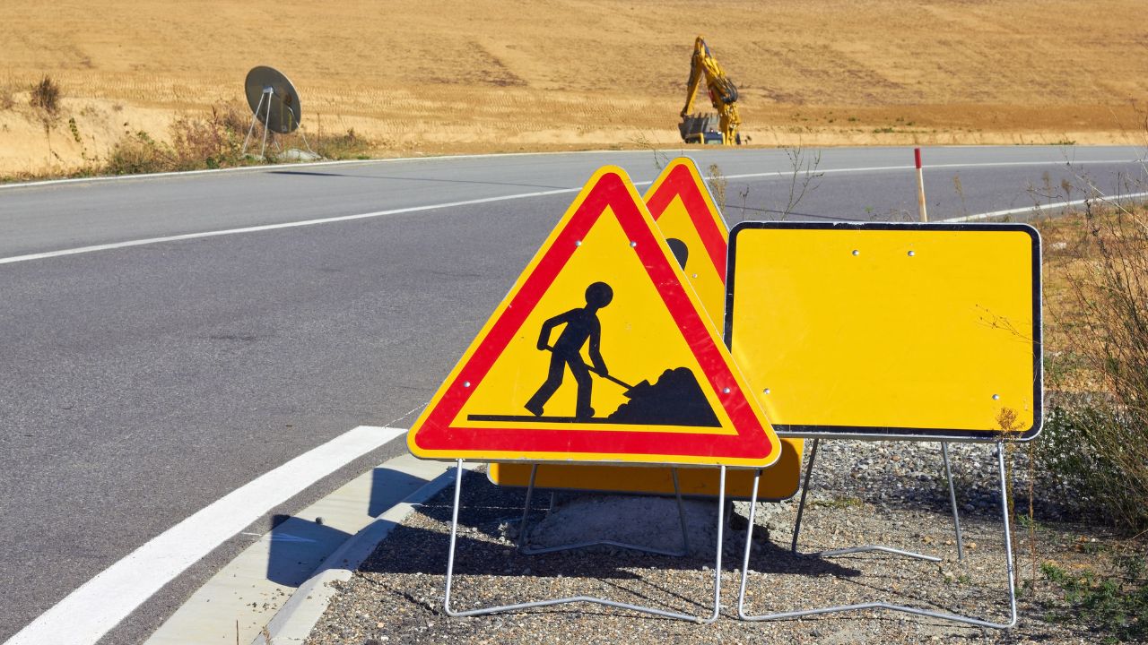
Marks communicate "facility presence + approximate location," not safe-to-dig clearance. The mark indicates where a utility is believed to exist horizontally but provides no guarantee of depth or exact position. Locating technology has limitations, signal interference, non-metallic materials, and congested corridors all affect accuracy.
Marks are the starting point for safe excavation, not the endpoint. They define where caution is required and where verification must occur before mechanical digging begins. Treat every mark as a warning flag that triggers additional investigation, not as permission to excavate.
Crews need instant recognition of what each color means and why it matters. The APWA Uniform Color Code is the industry standard across North America; memorizing these colors is non-negotiable for anyone operating excavation equipment or working in trenches. Color recognition prevents confusion, enables proper tolerance zone identification, and supports rapid emergency response when utilities are exposed.
| Color | Typically Indicates | Common Field Examples |
| White | Proposed excavation limits | Pre-marked work area boundaries, trench alignment |
| Pink | Temporary survey markings | Survey control points, property boundaries |
| Red | Electric power lines, cables, conduit | Transmission lines, service laterals, lighting circuits |
| Yellow | Gas, oil, petroleum, steam | Natural gas distribution, propane, fuel oil, steam heating |
| Orange | Communications, cable TV, fiber | Telephone, cable TV, fiber optic, alarm systems |
| Blue | Potable water | Water mains, service lines, fire hydrant supply |
| Purple | Reclaimed water, irrigation | Non-potable reuse systems, landscape irrigation |
| Green | Sewer and drain lines | Sanitary sewer, storm drains, catch basins |
A locate-first workflow only works if each step is completed in order; skipping steps breaks the chain.
Different technologies excel in different conditions. Site characteristics (soil type, moisture, congestion) and utility materials (metallic vs. non-metallic) significantly affect reliability. No single technology works perfectly in all situations; understanding strengths and limitations guides proper technology selection and prevents over-reliance on any one method for utility mapping and detection.
| Technology | Best For | Weak When | What You Get | Common Failure Modes | When to Choose It |
| EM Locator | Metallic utilities (copper, steel, iron) in open areas | Non-metallic pipes (PVC, HDPE), congested areas with signal interference | Horizontal trace of conductive utilities, approximate depth reading | Signal bleeding to adjacent metal, inaccurate depth on deep/parallel lines | Standard first-pass location for gas, water, electrical conduit |
| Ground Penetrating Radar (GPR) | Non-metallic utilities, concrete-encased conduit, general subsurface mapping | Wet/clay soils, highly conductive ground, very deep utilities (>15 ft) | Subsurface profile showing anomalies and reflections | Interpreting complex data, differentiating utilities from other buried objects | Verifying non-metallic lines, locating in congested corridors |
| Vacuum Excavation/Daylighting | Physical verification, exposing exact location and depth | None, most reliable method but slower and more costly | Visual confirmation of utility type, size, depth, and horizontal position | Limited to point locations (not continuous tracing), requires surface access | Final verification before mechanical excavation, utility crossings, critical infrastructure |
Most strikes come from repeatable failures. Use the warning signs below to intervene early, before damage occurs.
| Root cause | Early warning sign | Preventive control | Field check | Escalation action |
| No 811 notification | No ticket on file / rushed start | No ticket, no dig (company-wide) | Confirm ticket is posted before equipment arrives | Stop work → submit 811 request → document delay |
| Inaccurate marks | Marks don’t match meters/vaults/known features | Pothole/daylight at crossings + high-risk areas | Compare marks to as-builts + surface indicators | Request re-mark → use private locator if needed |
| Scope changed | Dig extends beyond white-line limits | Update 811 ticket when limits change | Confirm marks cover the active excavation zone | Submit new locate for expanded area |
| Expired ticket | Work continues past validity (often 14–28 days) | Track expirations; renew before lapse | Review ticket dates in daily toolbox talk | Stop work → renew ticket → document gap |
| Private lines not located | Commercial/campus sites; lots/lighting | Use private locator on non-residential sites | Ask owner about private utilities before digging | Bring private locator mid-job if suspected |
| Skipped verification | Schedule pressure; potholing skipped | Require potholing at every crossing | Supervisor spot-check before mechanical excavation | Stop mechanical excavation → verify → retrain |
| Poor crew briefing | Confusion on color codes/tolerance zones | Daily toolbox talk on locations + safe dig plan | Quick crew check on tolerance/hand-dig rules | Remove unqualified operators → refresher training |
| Mark destruction | Faded/removed flags; weather/traffic/trades | Inspect daily; request re-mark when unclear | Stop if marks are illegible in the work zone | Protect area → emergency re-mark → document delay |
Priority is always: stop work → secure → protect people → notify.
Immediate response (memorize):
Have ready when calling the utility:
Use enhanced verification when conditions make standard locating less reliable:
Private locators fill the gap between what 811 covers and what actually exists underground. Commercial properties, campuses, and industrial sites typically have extensive private infrastructure that won't appear on 811 marks. Waiting until mid-project to discover unmarked lines causes expensive delays, hiring a private utility locating service during planning prevents this.
Signals that suggest private lines are likely:
Deliverables required from private locate service:
This is the last gate before digging. If any answer is No, don’t excavate.
Locating isn’t paperwork; it’s the safety and cost-control foundation. Treat it as step one: call 811, verify by potholing, enforce tolerance zones, document, and escalate early. Crews that do this consistently prevent strikes, reduce liability, and protect schedule and reputation.
Need expert utility locating services for your next project? Contact Bess Utility Solutions to ensure your excavation starts safely and stays safe from day one.


