Hayward, CA
Fresno, CA
Orange, CA
Sacramento, CA
Phoenix, AZ
Key Takeaways:
Utility mapping services identify underground utilities before construction using advanced technology. This utility locating process follows ASCE 38-22 standards with four Quality Levels: QL-D (records research), QL-C (surface survey), QL-B (Ground Penetrating Radar and electromagnetic locating), and QL-A (vacuum excavation test holes). Professional underground utility locating services use GPR to detect all materials (±20-40% depth accuracy), electromagnetic locating equipment for metallic utility lines (±2-5 ft horizontal), and vacuum excavation for pinpoint utility location (±1 inch accuracy).
Underground infrastructure follows the APWA color code: RED (electric), YELLOW (natural gas), ORANGE (fiber optics), BLUE (water), GREEN (sewer mains), PURPLE (reclaimed water). This standardized marking system enables damage prevention by identifying critical infrastructure before excavation begins.
Utility strikes cost projects hundreds of thousands of dollars and create serious public safety risks. The CGA DIRT 2023 report shows 76% of utility damages stem from the same six root causes for three consecutive years—most involving failure to use proper utility locating services. Fiber optics accounts for 50% and natural gas lines represent 40% of all damage incidents, making damage prevention critical for protecting utility networks and critical infrastructure.
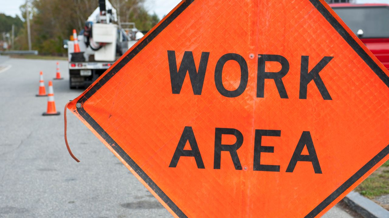
Construction delays plague half of all excavators because utility providers can't deliver timely locate services through 811 services (CGA DIRT 2023, 12-state analysis). Without professional underground utility locating services, projects face Differing Site Conditions (DSC)—the leading cause of contractor claims. Subsurface utility engineers eliminate "surprise" underground utilities that qualify as DSC under FAR 52.236-2 or AIA A201, preventing construction delays and protecting public utilities from costly utility strikes.
Utility mapping services deliver massive cost savings on construction projects by preventing utility strikes and eliminating construction delays. Professional underground utility locating services cost just 0.5-1.65% of total project budgets, while a single utility strike runs $50,000-$500,000+ in repairs, delays, and legal penalties. Private utility locating investments pay for themselves many times over through damage prevention and reduced change orders.
Underground utility locating represents a fraction of potential utility strike costs. Here's the cost comparison:
| Investment | Cost Range | What You Get |
| QL-D (Records Research) | $500-$2,000 | Basic utility location data from existing records |
| QL-C (Surface Survey) | $2,000-$10,000 | Visible utility infrastructure mapped with GPS utility mapping |
| QL-B (GPR/EM Locating) | $5,000-$30,000 | Ground Penetrating Radar and electromagnetic locating of underground utilities |
| QL-A (Vacuum Excavation) | $15K-$250K | Pinpoint utility location via test holes (±1 inch accuracy) |
| Total SUE Investment | 0.5-1.65% of the project | Complete underground infrastructure documentation |
Versus Single Utility Strike Costs:
Vacuum excavation test holes alone deliver 5:1 to 40:1 ROI, excluding schedule benefits. Locating services from professional locating companies protects critical infrastructure while ensuring public safety and avoiding utility network disruptions.
Private utility locating dramatically cuts construction delays and changes orders. Projects using subsurface utility engineers see 2-8% change order rates versus 15-30% without proper utility locating—a 60-75% reduction in utility-driven changes. The PennDOT 2012 study documented a 40.33% reduction in utility relocation costs (the largest cost savings construction driver) and a 29.46% reduction in design and construction costs through advanced technology and damage prevention.
Underground utility locating services eliminate 60-75% of utility-driven rework by identifying underground infrastructure conflicts during design—not during excavation. This facility management approach using CAD drawings and 3D BIM models prevents utility strikes before construction begins, protecting utility lines and avoiding 811 services emergency responses.
Underground utility locating services deliver documented returns of $2.73 to $22.21 for every dollar invested. Multiple independent studies confirm that utility mapping services provide exceptional cost savings for construction projects through damage prevention and reduced construction delays. Private utility locating pays for itself within weeks by preventing utility strikes and contractor claims.
Major infrastructure studies prove utility locating services generate significant ROI. Here's what subsurface utility engineers deliver:
| Study | ROI | Project Scope |
| Purdue University (2000) | $4.62 per $1 spent | 71 highway projects, >$1 $1B total value |
| Penn State (2007) | $22.21 per $1 spent | 10 utility mapping projects |
| PennDOT (2012) | $11.39 per $1 spent | 22 SUE vs. 8 non-SUE comparison |
| Louisiana DOTD (2021) | $2.73 per $1 spent | 3 projects (conservative estimate) |
| Ontario Study (2005) | $2.05-$6.59 per $1 spent | 9 large infrastructure projects |
| Commercial Buildings | $6-$25 per $1 spent | Expected ROI based on project complexity |
These returns come from preventing utility strikes, eliminating construction delays, and protecting critical infrastructure like natural gas lines, fiber optics, and public utilities. Advanced technology, including Ground Penetrating Radar, electromagnetic locating equipment, and vacuum excavation, delivers measurable cost savings through damage prevention.
Utility mapping services break even within the first avoided utility strike. Projects achieve 1.9% average construction cost reduction versus traditional approaches. A $50M project investing $250K-$500K in underground utility locating services eliminates $225K-$2.25M in utility rework—immediate payback through facility management and risk assessment.
Schedule compression adds 10-25% faster delivery. One case study saved 4 months on a 32-month project using subsurface utility engineers and CAD drawings for infrastructure mapping. Contractors bid 5-10% contingency with professional locate services versus 10-20% without proper utility location data. Contractor claims drop dramatically: 1-3 per project with GPS utility mapping versus 8-15 without—an 80-90% reduction protecting public safety and utility networks.
Utility mapping services should start during project planning—not during construction. Subsurface utility engineers follow a phased approach aligned with design milestones, using advanced technology appropriate to each stage. Early utility locating prevents construction delays and utility strikes by identifying underground infrastructure conflicts before mobilization. The "sweet spot" for cost savings construction is QL-B during design development (30-60% phase), when Ground Penetrating Radar and electromagnetic locating provide maximum damage prevention value.
| Project Phase | Completion % | Quality Level | Utility Locating Method |
| Planning | 0-10% | QL-D | Records research from utility providers and public utilities |
| Preliminary Design | 10-30% | QL-C | Surface survey with GPS utility mapping of visible utility lines |
| Design Development | 30-60% | QL-B | Ground Penetrating Radar + electromagnetic locating equipment ("sweet spot") |
| Final Design | 60-100% | QL-A | Vacuum excavation test holes at critical infrastructure points |
| Construction | Active Build | QL-A supplements | Additional utility location verification + Call before you dig 811 tickets (2 working days required) |
Private utility locating during design phases creates CAD drawings and 3D BIM models for infrastructure mapping. This facility management approach protects underground utilities, including natural gas, fiber optics, and sewer mains. During construction, 811 services provide Enhanced Positive Response for public utility locating services and private onsite utilities, ensuring Dig Safe compliance and protecting utility networks through proper damage prevention protocols.
Selecting professional underground utility locating services requires evaluating technical expertise, equipment capabilities, and liability protection. The best locating companies combine advanced technology with certified personnel who follow ASCE 38-22 standards for subsurface utility engineers. Quality private utility locating providers deliver accurate utility location data that prevents construction delays and protects critical infrastructure.
Look for these qualifications when choosing utility mapping services:
Top locate services providers offer comprehensive infrastructure mapping using modern technology for both public utilities and private onsite utilities, ensuring Dig Safe compliance and protecting utility networks throughout construction.
Professional utility mapping services combine multiple detection methods for complete underground infrastructure coverage. QL-B utility locating uses electromagnetic locating equipment, Ground Penetrating Radar, and acoustic detection simultaneously—capturing metallic utility lines, non-metallic pipes, and pressurized systems like natural gas and water. This multi-technology approach delivers superior damage prevention compared to single-method locate services.
Advanced infrastructure solutions, including 3D BIM models, reduce coordination time by 80-90%—just 8-16 hours versus 40-80 hours per cycle using traditional CAD drawings. Urban sites typically face 5-15 underground utility conflicts without subsurface utility engineers, but only 0-2 conflicts with proper utility location data. This infrastructure mapping prevents construction delays and protects critical infrastructure, including fiber optics, sewer mains, and utility networks.
All excavators must white-line dig areas before calling 811 services—a Dig Safe requirement in every state. Call before you dig 811 tickets remain valid 15-28 days (state-dependent) and require refresh requests if marks fade. Enhanced Positive Response systems from utility providers confirm locate completion for both public utilities and private onsite utilities. Accuracy improves dramatically through Quality Level progression: QL-D (30-70% inaccurate) → QL-B using GPS utility mapping and electromagnetic locating (±2-5 ft) → QL-A via vacuum excavation (±1 inch). This risk assessment approach protects public safety while delivering cost-saving construction through effective on-site utility management and facility documentation.
Bess Utility Solutions delivers comprehensive underground utility locating services using advanced technology, including Ground Penetrating Radar, electromagnetic locating equipment, and vacuum excavation. Our subsurface utility engineers provide accurate utility location data that prevents utility strikes, eliminates construction delays, and protects critical infrastructure. From GPS utility mapping to 3D BIM models and CAD drawings, we deliver complete infrastructure mapping solutions for commercial builds.
Don't risk costly utility strikes and construction delays. Contact Bess Utility Solutions today for professional locate services that follow ASCE 38-22 standards and deliver proven cost savings construction through damage prevention. Our certified team protects underground utilities, including natural gas, fiber optics, sewer mains, and utility networks—ensuring Dig Safe compliance and public safety throughout your project. Call before you dig with confidence using industry-leading private utility locating solutions.


