Hayward, CA
Fresno, CA
Orange, CA
Sacramento, CA
Phoenix, AZ
Key Takeaways
Ground Penetrating Radar promises to reveal what's hidden beneath our feet, buried utilities, archaeological treasures, structural defects, and geological features, all without breaking ground. But GPR isn't a magic X-ray machine that works everywhere. Its effectiveness depends entirely on what's underground: the soil type, moisture content, and the target you're trying to find. Understanding what GPR can locate and what it cannot detect is the difference between a successful survey and a wasted investment.
This article cuts through the marketing hype to explain the real-world limits of GPR technology, the conditions where it excels, and the scenarios where it fails completely.
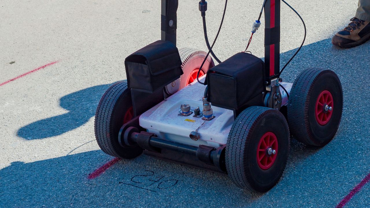
Ground Penetrating Radar is a non-destructive geophysical tool that uses electromagnetic waves to see underground. Its effectiveness depends entirely on the electrical properties of the ground and the objects being detected.
GPR sends high-frequency electromagnetic waves (25 MHz to 2.6 GHz) into the ground and records reflections from buried objects and material boundaries. The system's performance is governed by two electrical properties: dielectric permittivity (εr), which controls how fast the wave travels, and electrical conductivity (σ), which controls how quickly the signal loses energy through signal attenuation. Depth is calculated by converting the two-way travel time of the signal using the formula v = c / √εr, where c is the speed of light.
GPR detects objects by measuring reflections at boundaries where the dielectric properties change. The greater the contrast between materials, the stronger the reflection. Metal objects provide the strongest reflections (effectively infinite dielectric constant), followed by air voids (εr ≈ 1) and plastic pipes (εr ≈ 3) buried in soil. Targets fail when the contrast is low, for example, a concrete pipe buried in clay has similar dielectric properties to the surrounding soil, making it nearly invisible.
Two properties control GPR effectiveness. Dielectric permittivity determines wave velocity, higher values slow the wave down. Electrical conductivity controls attenuation, higher conductivity rapidly converts the signal to heat, limiting the radar range. This creates a fundamental trade-off in antenna selection: lower frequencies penetrate deeper but produce blurry images, while higher frequencies create sharp images but only work at shallow depths.
GPR excels when detecting objects with strong dielectric contrast in low-conductivity environments. Success depends on choosing the right frequency for the target depth and ensuring favorable soil conditions.
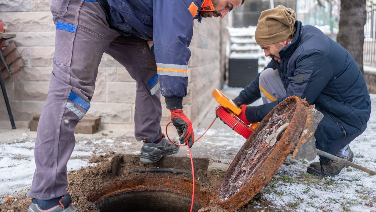
Professional underground utility locating relies heavily on GPR for non-metallic targets that other methods cannot find.
Air (εr ≈ 1) creates exceptional dielectric contrast against concrete (εr ≈ 6) or soil (εr ≈ 4-15), making void detection one of GPR's most reliable applications.
GPR successfully locates non-metallic archaeological features like ancient foundations, burial pits, and ditches in dry, sandy, or loamy soils. The disturbed soil from human activity provides sufficient dielectric contrast against undisturbed subsoil, allowing GPR to map features like Roman villas and prehistoric settlements without excavation.
| Material | Dielectric Constant (K) | Conductivity (mS/m) | Max Penetration | GPR Performance |
| Dry Sand | 3–5 | 0.01 | 10-50m | Excellent |
| Dry Concrete | 6–8 | 0.01 | 1.5m | Excellent |
| Ice/Granite | 3–10 | Very low | 100m+ | Excellent |
| Saturated Sand | 25–30 | 10–100 | Limited | Fair |
| Wet Clay | 25–40 | 100–1000+ | <1m | Poor |
| Saltwater | 80 | 1000+ | Centimeters | Extremely Poor |
GPR fails in highly conductive environments and struggles with small objects at depth. Understanding these subsurface detection limits prevents wasted survey effort and unrealistic expectations.
| Material | Dielectric Constant (K) | Conductivity (mS/m) | Max Penetration | GPR Performance | Why Less Effective |
| Dry Sand | 3–5 | 0.01 | 10-50m | Excellent | , |
| Dry Concrete | 6–8 | 0.01 | 1.5m | Excellent | , |
| Ice/Granite | 3–10 | Very low | 100m+ | Excellent | , |
| Saturated Sand | 25–30 | 10–100 | Limited | Fair | Water with dissolved minerals increases conductivity |
| Wet Clay | 25–40 | 100–1000+ | <1m | Poor | Soils with >15-20% clay severely depth-limited due to high conductivity |
| Saltwater | 80 | 1000+ | Centimeters | Extremely Poor | Coastal/industrial sites with salt make GPR virtually ineffective |
Maximum penetration depth is inversely proportional to signal attenuation. Typical ranges span 0.5-30 meters, with extremes from centimeters to over 100 meters depending on material conductivity. High conductivity converts electromagnetic energy to heat, causing the signal to decay before it can reach deep targets and return to the surface.
Wet clay (100-1000+ mS/m) attenuates the GPR signal within 30 centimeters to 1 meter of penetration. Saltwater intrusion, chemical contamination, and mineral-rich soils dramatically increase conductivity, absorbing the signal before it reaches the target depth. In these conditions, GPR is essentially blind, a major consideration for utility locating challenges in coastal or industrial areas.
The minimum detectable object size is approximately one-quarter of the signal's wavelength in the medium. A practical field rule states that objects must be at least 10% of their burial depth to be reliably detected. Resolution decreases with depth; a 5 cm object at 50 cm depth might be visible, but the same object at 5 meters is undetectable. Higher frequencies improve resolution but sacrifice penetration depth.
Environmental conditions and equipment selection determine whether a GPR survey succeeds or fails. Moisture content and antenna frequency are the two most critical variables affecting GPR limitations.
| Frequency (MHz) | Max Depth | Resolution | Typical Application |
| 25 | 40-80m | 0.5-1.0m | Deep geological studies |
| 100 | 10-20m | 0.1-0.25m | Utility location |
| 250 | 4-8m | 0.05-0.1m | Archaeology, utilities |
| 500 | 2-4m | 0.025-0.05m | Concrete scanning |
| 1000 | 1-2m | 0.01-0.025m | High-resolution concrete |
No single method works everywhere. GPR is typically used alongside complementary technologies, each compensating for the other's weaknesses.
GPR uses electromagnetic waves while seismic methods use acoustic waves. GPR excels at shallow, high-resolution imaging (centimeters to tens of meters), while seismic methods penetrate much deeper for geological structures (hundreds to thousands of meters). The methods are complementary; GPR maps shallow utilities and archaeological features, and seismic identifies deep bedrock and geological formations. Combined use is standard practice in site investigations.
GPR Advantages:
Drilling Advantages:
Best Practice: GPR for initial large-area surveys to identify target locations, followed by strategic drilling at specific points for ground-truth verification and calibration. GPR depth accuracy (±10-15%) requires physical confirmation for critical applications.
GPR applications span multiple industries, but success varies dramatically based on site-specific soil conditions. Each application faces unique challenges tied to the subsurface environment.
Urban utility locating before excavation is GPR's most common application. Operators must navigate utility locating challenges including disturbed soil, clay-rich native soils, and variable moisture content from leaking pipes or drainage. Wet clay backfill around utility trenches can create high-conductivity zones that limit penetration to 30 centimeters to 1 meter. The standard solution uses 250 MHz antennas, which balance depth penetration (4-8 meters in favorable conditions) against resolution adequate for utility detection.
GPR maps water tables in sandy aquifers where the sharp boundary between dry sand (εr = 3-5) and saturated sand (εr = 25-30) creates a clear, strong reflection. Additional applications include contaminant plume tracking, soil moisture estimation using Topp's equation, and bedrock depth mapping. Clay-rich environments fail because the water table becomes a gradual transition rather than a sharp boundary, and the high background conductivity prevents signal penetration. GPR works best in low-loss media, sand, gravel, and ice.
Forensic applications focus on detecting clandestine burials, locating buried evidence, and mapping crime scenes. Success depends on dry, non-conductive soils where disturbed soil from digging provides a dielectric contrast against undisturbed native soil. Recent burials in sandy or gravelly soils produce strong reflections; older burials in clay or heavily vegetated areas often fail due to soil homogenization and high conductivity.
GPR technology continues evolving to address current limitations, though fundamental physics constraints, particularly in high-conductivity environments, remain challenging.
Note: Future development topics represent general industry research directions and emerging technologies not yet standardized in field practice.
GPR is not universally applicable; it's highly site-specific. ASTM D6432 explicitly states that performance depends on the electrical properties of the subsurface materials being investigated. GPR becomes the go-to tool only in dry, non-conductive media like sand, gravel, dry concrete, or ice. It's unsuitable as a standalone method in wet clay, saline environments, or scenarios with low dielectric contrast between target and host material. The question isn't "Can we use GPR?" but rather "Will GPR work here?"
Understanding GPR's depth accuracy (±10-15%) enables proper velocity calibration using known targets or hyperbola fitting. Seasonal timing matters; surveys conducted during dry seasons achieve dramatically better penetration than those in saturated conditions. Appropriate frequency selection based on depth requirements and target size prevents wasted effort with unsuitable equipment. Even apparent "failures" provide valuable information: rapid signal attenuation in concrete indicates chloride contamination and potential corrosion, turning a limitation into a diagnostic tool.
Integration with complementary technologies is standard practice in professional subsurface investigations:
Multi-method approaches compensate for individual limitations, delivering comprehensive subsurface characterization that no single technology can achieve alone. For comprehensive subsurface investigation and utility locating services that combine multiple detection methods, experienced operators understand when to use GPR and when alternative technologies deliver better results.
Ground Penetrating Radar is one of the most powerful non-invasive tools for subsurface imaging, but only when the ground conditions and target contrast allow it. Dry, low-conductivity materials and strong dielectric boundaries can produce exceptionally clear results, while wet clay, saline soils, and metal shadowing can make GPR effectively blind. The most reliable outcomes come from treating GPR as a decision tool within a broader investigation strategy, paired with EM induction, ERT, or targeted drilling to confirm findings and close gaps. When you match the method to the site, you don’t just avoid wasted scans; you get actionable subsurface clarity.
Need expert subsurface investigation services that combine GPR with complementary technologies? Contact Bess Utility Solutions for professional utility locating and site assessment.