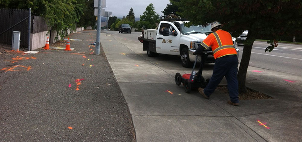
In the complex and ever-evolving landscape of urban development and infrastructure maintenance, utility locating stands out as a critical yet challenging task. In this guide, we’ll delve into the common challenges and provide effective strategies to overcome them, ensuring a safer and more efficient approach to urban development and maintenance.
Utility locating is the process of identifying and labeling public utility mains that are underground. These may include lines for electricity, gas, water, sewage, and telecommunication. Accurately locating these utilities is crucial to avoid damaging them during construction and maintenance activities, which can lead to costly repairs, service disruptions, and even dangerous accidents.
One of the primary challenges in utility locating is dealing with outdated, inaccurate, or incomplete records. Over time, utilities undergo numerous changes, upgrades, and re-routing, which may not always be accurately documented.
To counter this, professionals are now turning to advanced geophysical technology such as Ground Penetrating Radar (GPR) and electromagnetic induction. These technologies allow for a more accurate detection of utilities, irrespective of the documentation's accuracy.
Urban areas are densely packed with a myriad of underground infrastructures, which can cause signal interference, making it challenging to locate utilities accurately.
The use of multi-frequency locators helps differentiate between utilities and other structures. These locators can adjust frequencies to minimize interference and improve accuracy.
Gaining access to utility maps can be a bureaucratic and time-consuming process, which can delay projects.
Fostering collaboration between utility companies, local authorities, and contractors can streamline the process of mapping underground utility networks. Digital platforms and GIS (Geographic Information Systems) can be utilized to provide real-time, easily accessible maps.
Various environmental and soil conditions can hinder the utility locating process. Factors like soil type, moisture content, and the presence of other underground features can affect the accuracy of locating equipment.
Adapting locating techniques to specific environmental conditions is vital. For instance, in areas with clay and sandy soil, using lower frequency locating methods can yield better results.
Utility locating involves inherent safety risks, including the potential for accidental strikes on utility lines, leading to injuries or service disruptions.
Implementing and adhering to rigorous safety protocols and training programs can mitigate these risks. Regular drills and the use of safety equipment are essential.
The integration of new technologies in utility locating requires adequate training and skill development among workers.
Developing comprehensive training programs that focus on the latest technologies and best practices in utility locating is crucial for effective and safe operations.
Utility locating is a crucial aspect of urban development and infrastructure maintenance, demanding precision, efficiency, and safety. To achieve these, certain best practices must be consistently followed. Here, we outline these practices in a structured manner, focusing on how they contribute to effective utility locating.
Regular Training Programs: Consistently update the skills and knowledge of utility locating professionals. This includes familiarizing them with the latest technologies, techniques, and industry standards, ensuring they are equipped to handle various challenges in the field.
Certification Programs: Advocate or mandate certification for utility locators. This helps in standardizing the quality of work across the board and guarantees adherence to established industry best practices, thereby enhancing the overall reliability of utility locating.
Investing in Modern Equipment: Embrace the latest advancements in technology, such as Ground Penetrating Radar (GPR), electromagnetic induction, and other sophisticated tools. This investment significantly increases the accuracy and efficiency of utility location.
Regular Equipment Maintenance: Ensure that all equipment is regularly maintained and calibrated. This practice is vital for maintaining optimal performance and reliability, reducing the likelihood of errors due to faulty or poorly calibrated equipment.
Site Surveys: Before beginning the utility locating process, conduct comprehensive site surveys. This step is crucial for understanding the specific challenges and depth of utilities at a site, which aids in strategizing and planning the most effective locating approach.
Historical Data Review: Examine historical records and data about the site. This review can provide valuable insights into previously laid utilities and potential challenges or hazards, facilitating a more informed and cautious approach to locating.
Strict Safety Measures: Implement and strictly adhere to safety protocols to minimize the risks of accidents and utility damage. This includes training staff in safety procedures and ensuring compliance at all times.
Emergency Response Planning: Develop and maintain an effective emergency response plan. This ensures preparedness and swift, efficient action in case of accidental utility strikes or other emergencies, thereby mitigating potential hazards and damages.
Stakeholder Collaboration: Encourage active communication and collaboration among all parties involved, such as utility companies, construction teams, and local authorities. This collaboration is key to streamlining the location process and minimizing errors.
Clear Documentation: Maintain detailed and clear documentation of all aspects of the locating process. This practice is essential for future reference, accountability, and minimizing misunderstandings or disputes.
Utility locating comes with its own set of challenges, but with the use of advanced technology such as GPR systems and specialized software, along with experienced personnel, these challenges can be effectively overcome to ensure accurate and efficient utility locating.
Don't risk damaging underground utilities. Contact our team of experienced professionals for reliable utility locating services. Stay safe and avoid costly mistakes by entrusting your project to our skilled experts. Get in touch today for a consultation!
Common challenges in utility locating include signal interference, unclear data interpretation, and difficulty in recognizing patterns associated with different types of interference.
Advanced GPR systems with higher frequency options can minimize signal interference, providing clearer data for utility locating.
Specialized software is crucial as it filters out unwanted signals and helps in clearer data interpretation, overcoming the challenge of unclear data.