Hayward, CA
Fresno, CA
Orange, CA
Sacramento, CA
Phoenix, AZ
Construction projects consistently face a critical challenge: underground utilities that don't match the maps. Outdated records, unmarked infrastructure, and the inherent limitations of surface-based detection methods create a minefield of risk beneath every excavation site. The result? 509,000 excavation damage events annually in the U.S., driving costly change orders, dangerous utility strikes, and project delays that can derail even the most carefully planned construction.
The solution lies in combining two complementary verification methods: geophysical locating for broad coverage and vacuum excavation potholing for precision confirmation. This integrated approach transforms subsurface uncertainty into verified data, eliminating the guesswork that drives change orders.
By understanding how these methods work together and implementing them strategically, project teams can achieve dramatic reductions in utility-related disruptions while maintaining budgets and schedules.
Key Takeaways
Locating and potholing form a two-phase verification system that transforms utility data from approximate to definitive. Locating identifies where utilities likely exist; potholing confirms exactly where they are. Together, these methods eliminate the guesswork that drives costly change orders and project delays.
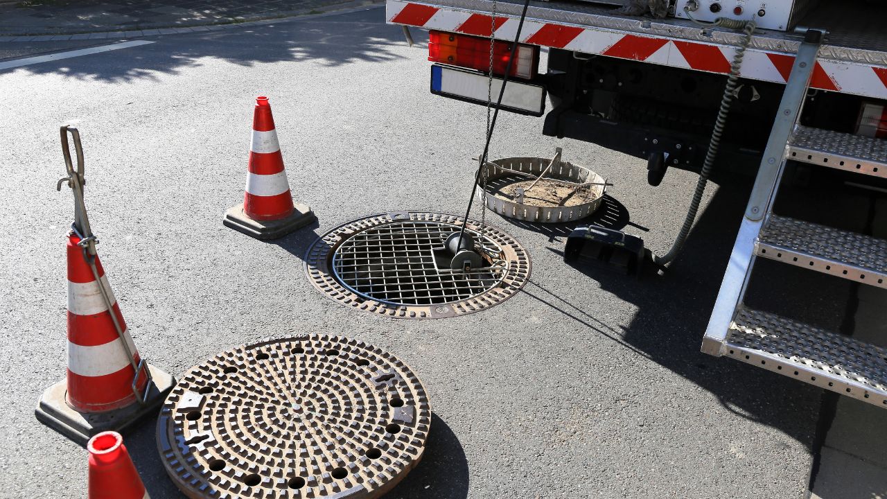
Utility locating uses surface geophysical tehttps://www.bessutilitysolutions.com/underground-locating-detection/chniques to determine the approximate horizontal position of underground utilities, classified as SUE Quality Level B. This provides a two-dimensional map of subsurface infrastructure without physical excavation.
| Method | Description | Pros | Cons | Primary Use Cases |
| Electromagnetic (EM) | Detects conductive materials using electromagnetic signals | Effective for metal utilities; 10-15 ft depth capability | Cannot detect non-conductive materials without tracer wire | Gas pipes, water lines, electrical conduits |
| Ground Penetrating Radar (GPR) | Uses radar pulses to image subsurface | Detects non-conductive pipes; provides depth data | Reduced performance in clay/saline soils; requires skilled operator | PVC pipes, concrete, fiber optics |
Key Stats:
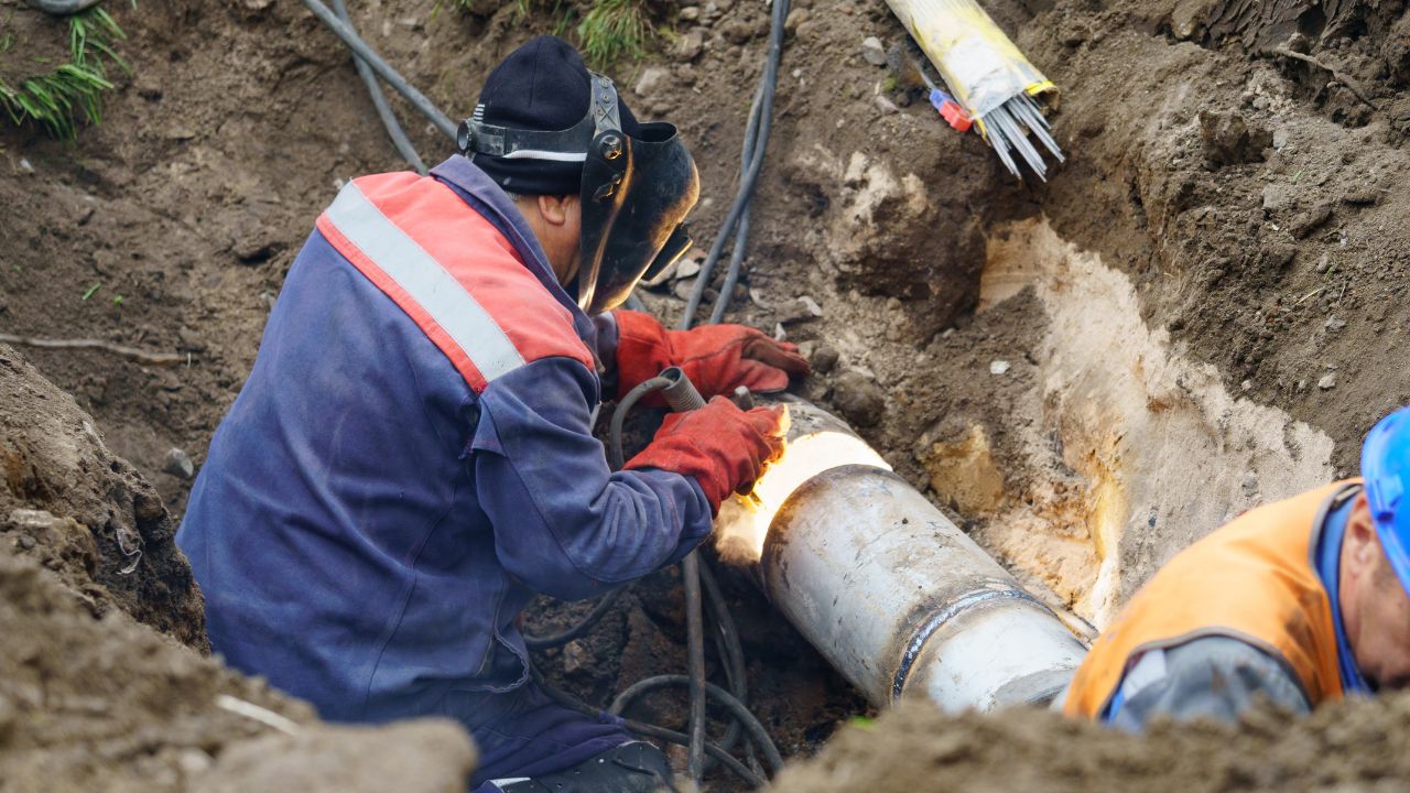
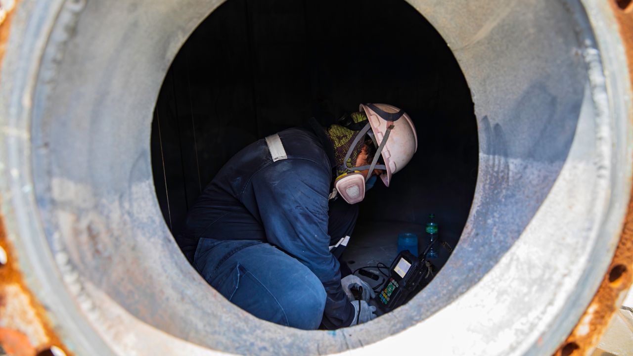
Potholing (vacuum excavation/daylighting) is non-destructive excavation that physically exposes utilities to confirm exact location, depth, material, size, and condition, achieving SUE Quality Level A (highest accuracy). This visual verification eliminates the tolerance margin inherent in locating methods, delivering superior utility locating accuracy.
Hydro Excavation (Hydrovac Trucks)
Air Excavation
Survey-Grade GPS Equipment
Adding potholing to a locate plan eliminates the 18-24 inch tolerance margin of geophysical methods, providing visual confirmation that prevents unforeseen utility conflicts requiring costly redesigns. This two-phase approach identifies utility locations broadly, then verifies them precisely where conflicts are most likely.
Key Benefits:
The potholing benefits extend beyond accuracy to encompass comprehensive risk reduction across the entire project lifecycle.
The combination transforms project planning by replacing assumptions with verified data, enabling engineers to design around actual conditions rather than mapped approximations.
Impact on Project Planning
| Planning Area | Locating (QL-B) Impact | Potholing (QL-A) Impact | Combined Benefit |
| Risk Reduction | Identifies approximate locations | Confirms exact position | Eliminates utility strike risk |
| Design Optimization | Provides 2D utility map | Delivers precise 3D coordinates | Conflict-free final design |
| Cost Estimation | Reduces major unknowns | Eliminates unforeseen relocation costs | Prevents 10-30% budget overruns |
| Schedule Accuracy | Identifies conflict zones early | Confirms conditions pre-construction | Maintains timeline without delays |
Investment: SUE costs 2-5% of the project budget with $4.62-$206 ROI per dollar spent
Problems Solved:
Unforeseen Subsurface Conditions
Project Delays
Budget Overruns
Safety Hazards
Regulatory Note: OSHA 29 CFR 1926, Subpart P mandates exact utility location determination before excavation. Understanding these liability requirements is critical for contractors and engineers.
Change orders stem from the gap between what designers think exists underground and what contractors actually find. Locating and potholing can close this gap during design, when adjustments cost less than during construction.
Primary Causes:
Inaccurate Design Information
Unforeseen Site Conditions
Misunderstandings
Scope Changes
Unreliable data forces contractors to encounter conflicts during excavation rather than addressing them during design. Each data quality level carries a different risk.
Data Quality Impact
| Data Type (SUE Level) | Common Inaccuracies | Impact | Change Order Risk |
| QL-D: Utility Records | Outdated; human error; no real-time updates | High uncertainty | Very High - maps "notoriously unreliable" |
| QL-C: Visual Survey | Only above-ground features | Incomplete subsurface picture | High - missing buried data |
| QL-B: Geophysical Locating | 18-24" tolerance; affected by soil/operator skill | 2-3 ft accuracy | Moderate - approximate only |
| QL-A: Potholing | Minimal when properly executed | Sub-inch accuracy | Very Low - verified data |
Locating and potholing shift verification from the construction phase to the design phase, where changes cost less and cause fewer delays.
Accuracy Mechanisms:
Real-Time Verification
Pre-Construction Conflict Identification
Cost Avoidance
Recommended Workflow:
Accurate subsurface data shifts costs from reactive (emergency repairs, change orders) to proactive (planned design adjustments). This fundamental shift transforms unpredictable overruns into manageable, budgetable investments, delivering substantial project cost savings.
The combined approach frontloads a small investment to prevent exponentially higher costs later. Projects recoup SUE expenses multiple times over through avoided strikes and eliminated change orders.
Cost Comparison
| Project Phase | Without SUE | With SUE | Difference |
| SUE Investment | $0 | 2-5% of budget | +2-5% upfront |
| Utility Conflicts | $5,000-$50,000+ per strike | Minimal incidents | -60-80% reduction |
| Change Orders | 10-30% budget overruns | Minimal utility-related | -60-80% reduction |
| Net ROI | Unpredictable costs | $4.62 saved per $1 spent | 4:1 to 206:1 return |
Early detection converts surprises into planned responses, reducing both direct repair costs and cascading project impacts.
Early Detection Savings:
Hidden Utilities
Unexpected Depths
Conflicting Infrastructure
Unstable Conditions
Long-term Benefits
Verified utility data eliminates exploratory work and prevents the cascading delays that follow utility strikes. Contractors work confidently, maintaining continuous progress rather than stopping to investigate or repair.
Accelerated Steps:
Site Preparation
Utility Relocation
Excavation/Trenching
Reduced Delays
Stat: 509,000 annual excavation damage events occur without proper verification
Change orders don't just cost money; they consume time through design revision, permit amendments, and contractor remobilization. Eliminating utility-related changes keeps projects moving forward.
Schedule Benefits:
Fewer Rework Cycles
Reduced Permit Waiting
Predictable Timelines
Effective utility verification requires the right technology for each phase: geophysical methods for broad coverage, vacuum excavation for precision verification, and GPS for accurate documentation.
Key Technologies
| Technology | Primary Use | Key Benefits | Accuracy |
| EM Locators | Conductive utility locating | Effective for metal pipes; widely available | 18-24" tolerance |
| GPR | Non-conductive/conductive locating | Detects PVC/concrete; depth data | 18-24" tolerance |
| Hydrovac/Vacuum Excavation | Physical utility exposure | Non-destructive; all soil types | Sub-inch (QL-A) |
| Survey-Grade GPS | Precise documentation | Exact coordinates; GIS/CAD integration | Sub-inch position |
Standards: ASCE 38-22 (SUE levels), ASCE 75-22 (data exchange), OSHA 29 CFR 1926 Subpart P, SAE J3107
Consistent application of industry standards and systematic workflows prevents gaps in verification that could undermine the entire effort.
Best Practices Checklist:
Equipment & Training:
Project Planning:
Documentation:
Collaboration:
Real-world data demonstrates the dramatic impact of SUE implementation. Projects across highway construction, directional drilling, and foundation work consistently show how verified utility data prevents the costly surprises that drive change orders.
Project Examples:
Highway Construction:
Directional Drilling:
Foundation Work:
Documented comparisons reveal the stark difference between projects that verify utilities and those that rely on outdated records or approximate methods.
Comparison: With vs. Without SUE
Projects WITHOUT Locating/Potholing:
Projects WITH Locating/Potholing:
Key Lessons:
The evidence is compelling: combining locating and potholing delivers 60-80% fewer utility-related change orders with a $4.62+ return for every dollar invested. Implementation requires upfront planning but pays dividends throughout the project lifecycle.
Implementation Strategy:
Immediate Actions:
Expected Results:
Choose Locating + Potholing When:
By investing in verified subsurface data upfront, you transform underground uncertainty into actionable information, enabling confident designs, predictable construction, and successful delivery without costly change orders.
Ready to eliminate utility-related change orders on your next project? Contact Bess Utility Solutions to implement a comprehensive locating and potholing strategy tailored to your needs.