Hayward, CA
Fresno, CA
Orange, CA
Sacramento, CA
Phoenix, AZ
California commercial developments face dense underground utility networks, aging infrastructure, and strict safety requirements that make subsurface uncertainty expensive. GPR scanning provides survey-grade accuracy to detect existing utilities, reduce design conflicts, and protect construction schedules before excavation begins. This technology is essential for urban infill projects, industrial facilities, institutional campuses, and mixed-use developments where poor subsurface understanding leads to change orders and utility strikes.
The California construction market supports an estimated USD 14.8 million in GPR services for construction and infrastructure in 2025, projected to reach USD 20.9 million by 2030. Demand concentration is strongest in Los Angeles, the San Francisco Bay Area, and Sacramento.
Key Takeaways
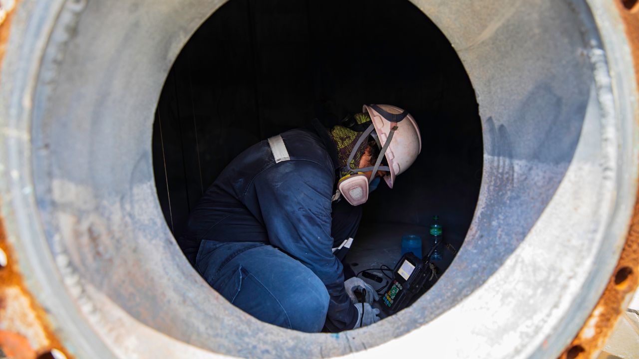
Ground-penetrating radar transmits high-frequency electromagnetic pulses into the ground and records reflections from subsurface features, including utilities, voids, and structural elements. GPR concrete scanning and utility detection work because different materials reflect electromagnetic energy at different rates, creating subsurface profiles that trained operators interpret to identify underground infrastructure. This non-destructive method detects both metallic and non-metallic targets, providing critical data before design lock-in or excavation authorization.
Commercial developments use GPR to verify existing utility locations, support site planning decisions, and reduce strike risk during construction. Understanding what is GPR and how does it work helps project teams evaluate when this technology delivers the highest return on investment.
GPR detects subsurface utilities by measuring the time and amplitude of electromagnetic wave reflections returning from underground objects and soil interfaces. Professional workflows integrate GPR with electromagnetic locating, survey control, visible utility evidence, records review, and GIS integration to produce defensible subsurface maps.
GPR performance degrades in clay, conductive, or high-moisture soils where electromagnetic attenuation limits penetration depth and signal clarity. GPR technology and innovation continue addressing these challenges through multi-channel arrays, improved signal processing, and complementary electromagnetic methods.
Accurate utility mapping delivers USD 11.39 in savings for every USD 1 spent, with 9.08% reduction in project delays, 9.59% reduction in redesign costs, 29.46% reduction in construction and design costs, and 40.33% reduction in project relocation costs. Professional GPR surveys during site planning prevent expensive conflicts that would otherwise surface during excavation or foundation work.
Early subsurface investigation improves design certainty and allows civil engineers to route utilities, foundations, and site improvements around confirmed conflicts. Commercial developments benefit most when GPR is integrated into preconstruction workflows rather than deployed reactively after underground surprises halt construction progress.
More than 20% of annual buried infrastructure damages are attributed to locating issues, creating safety incidents, and schedule slippage on construction projects. Inaccurate locating leads to utility strikes that trigger injuries, service outages, regulatory penalties, and project delays far exceeding the cost of professional subsurface investigation. How GPR improves safety in excavation construction focuses on damage prevention through higher-accuracy detection before excavation authorization.
Missed utilities cause rework, labor idle time, permit disruption, and claims that erode project margins and client relationships.
Professional GPR utility surveys represent the largest application category at 34% of California demand because they serve preconstruction detection, design verification, and excavation risk reduction. Utility relocation support follows at 26%, driven by highway, rail, transit, and corridor upgrades, where relocation planning errors create multimillion-dollar cost overruns. Commercial development scanning accounts for 18% of demand, concentrated in urban infill, industrial, institutional, mixed-use, and data-center projects requiring site planning certainty.
Transportation corridor mapping represents 14% of demand, supporting rail, roadway, airport, and transit programs needing survey-grade subsurface data. Concrete and structural scanning comprises 8% of demand, serving building contractors who must locate embedded rebar, conduit, and post-tension elements before coring or demolition.
Professional GPR utility surveys account for approximately 34% of California demand because they provide the subsurface confidence needed before design finalization or construction bidding. Utility detection represented 24.25% of the global GPR market in 2025, reflecting widespread recognition that accurate underground mapping prevents expensive conflicts.
Contractor surveys reveal that 73% of respondents reported weaknesses in the 811 process, with 78% naming inaccurate locating as the biggest problem. These deficiencies drive demand for private utility investigation services that deliver higher accuracy, better documentation, and stronger legal defensibility.
Utility relocation support represents 26% of California demand because relocation errors on major infrastructure projects create extraordinary cost overruns and schedule delays. The California High-Speed Rail project experienced USD 400 million in additional costs in one phase alone due to utility relocation issues stemming from insufficient subsurface understanding.
Utility conflicts discovered late in design or during construction force expensive redesign, permit amendments, and construction sequencing changes that cascade through project schedules.
Concrete and structural scanning represents approximately 8% of California demand, serving contractors who must locate embedded features before invasive work begins. Commercial development scanning accounts for 18% of demand, supporting site planning, utility verification, and as-built mapping on urban and mission-critical private projects.
Structural scanning detects rebar, conduit, post-tension cables, and voids inside concrete slabs, walls, and beams before drilling, coring, or cutting operations. This prevents damage to structural elements and embedded services that would otherwise compromise building integrity or trigger expensive repairs.
Engineering and subsurface utility engineering firms represent 32% of user adoption because they package GPR inside higher-value design, survey, mapping, and quality-level workflows. Public agencies, departments of transportation, and transit authorities account for 24% of adoption, driven by capital programs in transportation, water, transit, and civic infrastructure. Utility owners and operators represent 18% of adoption, using GPR for relocation verification, GIS-quality improvement, and conflict management.
General contractors comprise 16% of adoption, engaging GPR to reduce strike risk and maintain excavation progress when record drawings are incomplete. Developers and owners' representatives account for 10% of adoption, concentrated in dense urban, industrial, healthcare, education, and data-center projects where subsurface uncertainty threatens project feasibility.
Engineering firms prioritize GPR scanning because accurate subsurface data reduces design liability and supports defensible project deliverables. Public agencies prioritize GPR on infrastructure projects where delays and utility strikes create public-service disruptions and political accountability pressures. General contractors prioritize GPR when excavation schedules are tight, and strike risk threatens critical-path activities or workforce safety.
Developers prioritize GPR on complex urban sites where land values are high, and schedule certainty directly affects financing costs and market timing. Utility owners prioritize GPR when system expansion or relocation programs require verified subsurface conditions before capital authorization.
Los Angeles–Orange–Inland Empire represents 34% of regional adoption, driven by Metro's USD 26.8 billion capital program plus broader airport, roadway, rail, utility, and private development activity. The San Francisco Bay Area accounts for 24% of adoption, supported by dense utility networks, transit expansion, campus construction, healthcare facilities, and technology-sector infrastructure. Sacramento and Northern Valley represent 16% of adoption, reflecting state government facilities, water infrastructure, and transportation programs.
Central Valley and San Diego–Imperial each account for approximately 10% of adoption, serving agricultural infrastructure, border facilities, military installations, and regional transportation corridors. The Central Coast represents 6% of adoption, concentrated in university campuses, water utilities, and municipal public works.
Public infrastructure accounts for 58% of sector adoption because transportation, water, transit, airport, and civic capital programs generate consistent demand for professional subsurface investigation. California infrastructure funding totals USD 109.1 billion in combined federal and state investment since 2021, creating sustained demand for GPR services throughout project planning, design, and construction phases. Private commercial represents 42% of adoption, concentrated in urban infill, industrial facilities, institutional campuses, and mission-critical developments where subsurface certainty protects project economics.
Public-sector buyers typically require higher documentation standards, survey integration, and quality-level compliance. Private-sector buyers often prioritize speed and schedule certainty but increasingly demand the same accuracy when project complexity or land costs justify premium investigation services.
Buyers prioritize accuracy, safety, and schedule certainty ahead of the lowest upfront cost when underground consequences are material. Accuracy represents 34% importance share in buyer decisions because inaccurate subsurface data triggers redesign, change orders, and utility strikes that far exceed survey-cost savings. Safety and risk reduction account for 27% importance share, driven by contractor liability, regulatory penalties, and public-service disruption resulting from utility strikes.
Speed and schedule certainty represent 23% importance share because construction delays impose carrying costs, financing penalties, and lost revenue that compound daily. Cost accounts for only 16% importance share when buyers understand that professional subsurface utility engineering represents approximately 1.65% of the project budget, but can prevent delays costing exponentially more.
Accuracy dominates buyer priorities at 34% importance share because subsurface errors create cascading failures in design, permitting, bidding, and construction execution. Locators rated accuracy at 9.6 out of 10, safety at 9.3 out of 10, and on-time performance at 9.1 out of 10. Users demand tolerances better than 100 millimeters at depths to 3 meters and sometimes 5 meters, requiring premium technology and experienced interpretation teams.
Inaccurate utility locations force expensive redesign when conflicts are discovered during final engineering or permit review. Underground locating detection accuracy directly determines whether project budgets, schedules, and stakeholder commitments remain achievable throughout construction delivery.
Safety and risk reduction account for 27% importance share because utility strikes create injuries, regulatory violations, and public-service outages that expose contractors to liability and owners to reputational damage. Speed and schedule certainty represent a 23% importance share because construction delays trigger financing penalties, extended overhead costs, and lost revenue exceeding direct strike-repair expenses.
Projects with aggressive completion deadlines cannot afford unexpected utility conflicts that halt excavation, trigger permit amendments, or force design modifications after construction authorization.
Cost represents only 16% importance share because professional subsurface investigation prevents expenses that dwarf upfront survey fees. Professional subsurface utility engineering costs approximately 1.65% of the total project budget but delivers documented savings exceeding 9% through reduced delays, redesign, construction costs, and relocation expenses.
Buyers who focus exclusively on the lowest survey price often experience higher total project costs when inaccurate subsurface data triggers change orders or utility strikes. Combining utility locating and potholing to reduce change orders demonstrates how integrated investigation workflows prevent expensive conflicts.
Budget GPR services typically cost USD 800-1,500 per day and provide paint or flag marks with simple field notes suitable for small, well-defined scanning tasks. Mid-range services cost USD 1,500-3,000 per day and include mark-outs, summary reports, and basic CAD or GIS deliverables supporting routine commercial or civil-site work. Premium services cost USD 3,000-5,000 per day and deliver integrated utility maps, deeper analysis, survey alignment, and higher-confidence interpretation required for dense utility environments and corridor-scale projects.
Service-tier selection should align with project complexity, underground risk, and deliverable requirements rather than the lowest quoted price. Smaller tasks may be billed at USD 250-300 per hour plus mobilization fees ranging from USD 250-500.
Budget services provide basic field marking and simple documentation adequate for small projects with low underground complexity. Mid-range services add structured reporting, digital deliverables, and coordination with design teams, making them suitable for standard commercial developments and civil infrastructure. Premium services offer full survey integration, 3D utility mapping, soil-condition analysis, and engineering-grade deliverables supporting complex urban sites, major infrastructure corridors, and projects where subsurface uncertainty poses material schedule or cost risk.
Budget services sacrifice documentation quality and legal defensibility to minimize upfront cost. Premium services provide the confidence and documentation needed for high-value projects where design accuracy, regulatory compliance, and stakeholder accountability justify higher investigation investment.
Budget-tier deliverables consist of temporary paint marks and minimal field notes that provide short-term excavation guidance but lack permanent records or survey-grade accuracy. Mid-range deliverables include digital maps, summary reports, and basic integration with design drawings. Premium deliverables provide survey-controlled utility maps, detailed interpretation reports, soil-condition analysis, and GIS-ready formats that integrate directly into design workflows and asset-management systems.
Service-tier selection directly affects project outcomes because inadequate investigation quality triggers the same delays, conflicts, and strikes that GPR is intended to prevent.
Premium GPR services are economically justified when subsurface uncertainty threatens project budgets, schedules, or safety outcomes exceeding the cost differential between service tiers. Projects involving dense urban utility networks, aging infrastructure, major relocations, or mission-critical timelines should select premium services because the cost of design errors or utility strikes far exceeds investigation-price differences. Hydro vacuum excavation combined with premium GPR provides the highest confidence level for critical conflict points where direct confirmation is required before design lock-in.
Average GPR scanning costs range from USD 1,000 to 5,000 per day, depending on service tier, project complexity, and deliverable requirements.
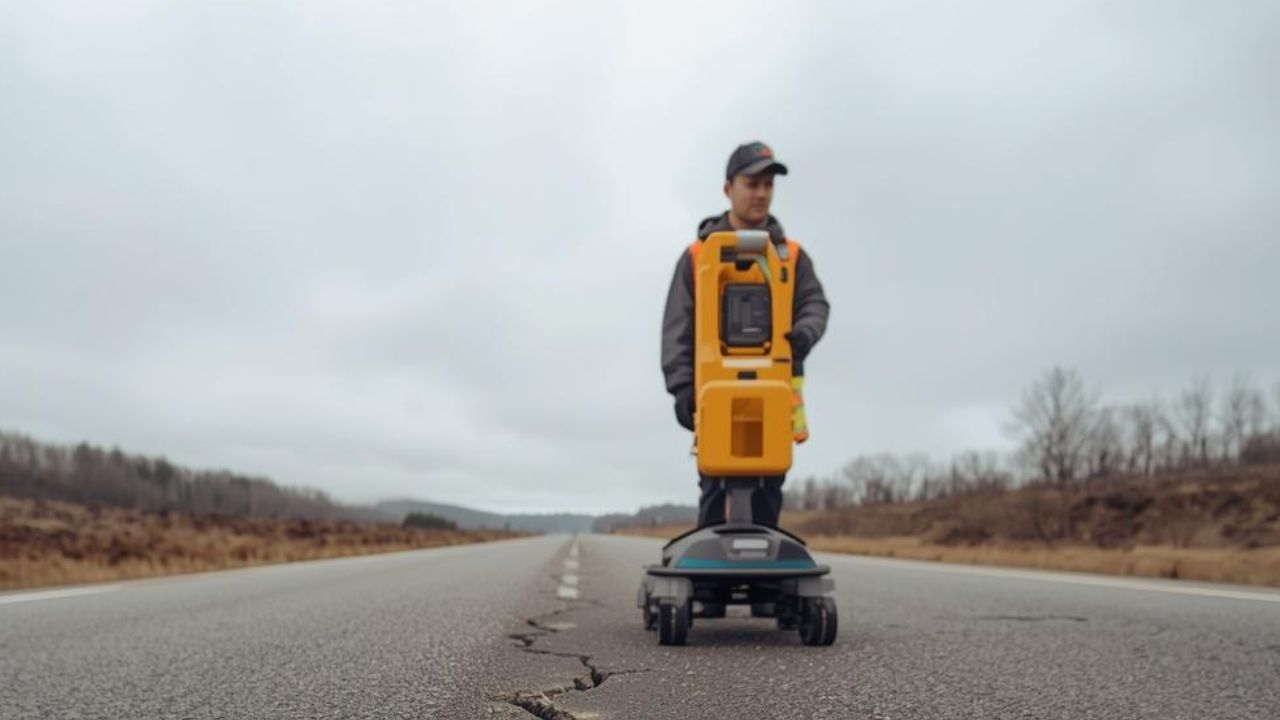
Single-channel GPR offers operational flexibility and reasonable productivity for routine utility surveys, but provides less rich corridor data than multi-channel systems. Multi-channel and 3D GPR deliver superior corridor productivity, deeper context, and better visualization, but require higher equipment investment and experienced processing teams to interpret complex datasets. Both approaches experience performance limitations in clay and conductive soil conditions where electromagnetic attenuation reduces penetration depth.
Electromagnetic locating and time-domain electromagnetic induction perform better than GPR for metallic utilities in conductive environments, but prove less effective for non-metallic targets. Vacuum excavation provides the highest confidence through direct exposure but remains the slowest and most expensive per investigation point, making it suitable for final confirmation at critical conflict locations rather than broad-area detection.
Single-channel GPR provides operational flexibility and lower equipment costs, making it suitable for site planning, commercial developments, and utility surveys where corridor productivity is less critical. Multi-channel GPR improves corridor productivity through simultaneous data collection across multiple antenna frequencies, generating richer 3D datasets that support complex corridor mapping and transportation infrastructure projects.
Both single-channel and multi-channel GPR experience soil-sensitivity issues in clay, high-moisture, and conductive conditions, where signal attenuation limits detection depth.
Electromagnetic and time-domain electromagnetic induction locating complements GPR by providing superior performance for metallic utilities and tracer-wire detection in conductive soil environments. These methods prove less effective for non-metallic targets such as PVC, concrete, or fiber-optic conduits lacking traceable electromagnetic signatures. Federal Highway Administration guidance recommends multi-sensor approaches combining GPR, electromagnetic locating, and vacuum excavation.
QL-A vacuum excavation refers to the highest confidence level of utility investigation, involving direct excavation confirmation at critical conflict points. Utility locating workflow locate mark verify excavate describes how integrated investigation combines detection, marking, verification, and excavation steps to deliver defensible subsurface certainty.
Complex California commercial sites require integrated subsurface investigation combining GPR, electromagnetic locating, survey control, records review, and selective vacuum excavation to address mixed utility types and difficult soil conditions. Dense urban infill, industrial, institutional, mixed-use, and data-center projects drive commercial demand for multi-sensor workflows that overcome GPR limitations in conductive soils while detecting non-metallic utilities invisible to electromagnetic methods.
Integrated workflows require stronger upfront coordination but deliver higher confidence and lower total project risk than single-method investigations.
Developers invest in GPR scanning to reduce project delays, change orders, and utility strikes that threaten project economics. Delay reduction represents 28% of buyer motivation because construction schedules drive financing costs, market timing, and revenue realization on commercial developments. Strike prevention accounts for 24% of motivation, protecting crews, existing infrastructure, and public services while avoiding regulatory penalties and liability claims.
Improved design certainty represents 22% of motivation, enabling civil engineers and architects to finalize site plans, foundation layouts, and utility routing with confidence in subsurface conditions. Relocation-planning support accounts for 14% of motivation on projects requiring utility modifications, while documentation and compliance improvement represents 12% of motivation.
GPR reduces project delays by detecting utility conflicts during site planning and design rather than during excavation when schedule impacts compound rapidly. Documented studies demonstrate 9.08% reduction in project delays and 9.59% reduction in redesign costs when accurate utility mapping informs design decisions before construction authorization.
Early subsurface investigation allows project teams to route foundations, utilities, and site improvements around confirmed conflicts instead of discovering obstacles after excavation mobilization.
Improved design certainty enables architects and civil engineers to finalize site layouts with confidence that subsurface conditions support proposed improvements without expensive modifications during construction. Dense urban infill sites contain aging utilities, abandoned infrastructure, and poorly documented subsurface features that create design uncertainty. Industrial sites often require heavy foundations, deep utilities, and extensive site grading that expose projects to subsurface conflicts.
Design certainty protects project economics by preventing redesign cycles, permit delays, and contractor claims that emerge when subsurface reality contradicts record drawings.
Buyers commonly object that upfront GPR costs strain project budgets, but this concern ignores documented evidence that USD 1 spent on accurate utility mapping returns USD 11.39 in avoided delays, redesign, construction costs, and relocation expenses. Buyers who believe 811 locating or record drawings provide sufficient subsurface data overlook contractor surveys showing 73% report weaknesses in the 811 process, and 78% cite inaccurate locating as the primary deficiency.
Interpretation quality varies significantly by provider experience, equipment capability, and quality-level compliance, making vendor selection critical. Depth confidence may require vacuum-excavation confirmation at critical conflict points, but this integrated approach still costs far less than utility strikes or construction delays.
The U.S. GPR market reached USD 173.67 million in 2024 and USD 185.9 million in 2025, with projections indicating USD 367.13 million by 2035 at 7.04% compound annual growth rate. California's construction-and-infrastructure GPR market is estimated at USD 14.8 million in 2025, growing to approximately USD 20.9 million by 2030 at 7.2% annual growth. This expansion reflects California's USD 109.1 billion in combined federal and state infrastructure investment since 2021, plus sustained commercial development activity.
Commercial developers and contractors who integrate GPR scanning into site planning and construction workflows achieve measurable reductions in utility strikes, project delays, and change-order costs that protect profit margins and stakeholder confidence. California's dense utility networks, aging infrastructure, and strict safety expectations make professional subsurface investigation essential on projects where underground uncertainty threatens schedule, budget, or safety outcomes. Bess Utility Solutions delivers ASCE 38-compliant subsurface utility engineering throughout California, combining 29 years of continuous operation with advanced GPR technology, vacuum excavation, and survey-grade deliverables that reduce project risk from initial site planning through construction completion.
Professional GPR investigation protects commercial developments by converting underground uncertainty into actionable subsurface data that informs design decisions, construction sequencing, and risk mitigation before expensive conflicts emerge.
Unknown underground utilities don't have to threaten your schedule, budget, or crew safety. Bess Utility Solutions delivers ASCE 38-compliant GPR scanning, vacuum excavation, and survey-grade subsurface mapping across California — giving your project team the accurate, defensible data needed from site planning through construction completion.
With 29 years of experience and 1,000+ satisfied clients, our licensed professionals integrate advanced GPR technology with electromagnetic locating and QL-A potholing to detect every utility — metallic or non-metallic — before a single shovel hits the ground. Contact Bess Utility Solutions today and build your next California commercial development with confidence.
Disclaimer:
All pricing information provided in this article is for general informational purposes only and may not reflect current rates. Actual costs can vary based on project scope, site conditions, and specific service requirements. For accurate pricing and a customized quote, please contact Bess Utility Solutions directly.