Hayward, CA
Fresno, CA
Orange, CA
Sacramento, CA
Phoenix, AZ
Key Takeaways
When preparing a site for construction or excavation, one of the most crucial steps often goes unnoticed—utility locating. With underground utilities being both hidden and vital to the functionality of a site, proper utility locating services can save you from major headaches down the road.
Mistakes in identifying and mapping underground utilities can lead to costly repairs, project delays, and even safety hazards.
In this article, we’ll explore how utility locating plays a pivotal role in site preparation and offer 10 practical tips to help avoid expensive errors during the process.
Before any construction or excavation work begins, identifying and mapping underground utilities is essential. These buried infrastructures can range from water pipes and gas lines to electrical cables and sewer systems, each of which plays a critical role in the functionality of a property. If these utilities are not properly located and mapped, it can result in disruptions, unexpected repairs, and serious risks to both workers and the property.
Accurately identifying and mapping underground utilities is crucial for the success of any excavation or construction project. Missing or incorrectly identifying utilities can lead to costly mistakes, delays, and safety risks. Here are the 10 ways to avoid these mistakes and ensure a smoother, safer project.
Hiring professionals with experience in utility locating is essential to prevent costly errors. Trained and skilled technicians know how to use specialized equipment effectively, ensuring precise detection of various utilities such as gas lines, electrical cables, and water pipes.
Experienced locators can also differentiate between metallic and non-metallic utilities, which may require different techniques for accurate detection.
Why It Matters:
When utility locators are not skilled, they might overlook critical details, resulting in dangerous accidents or delays. Experienced locators can spot potential hazards that less experienced workers might miss.
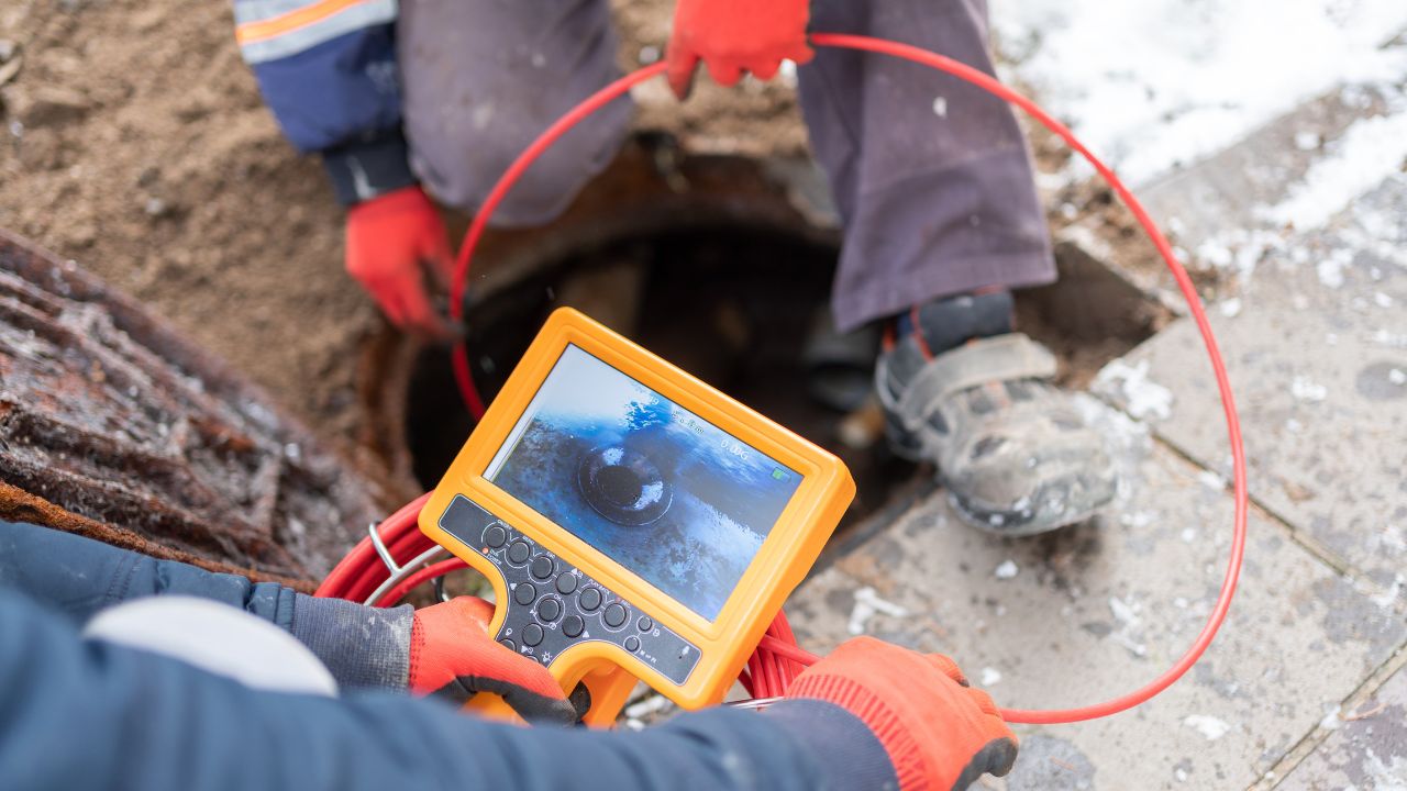
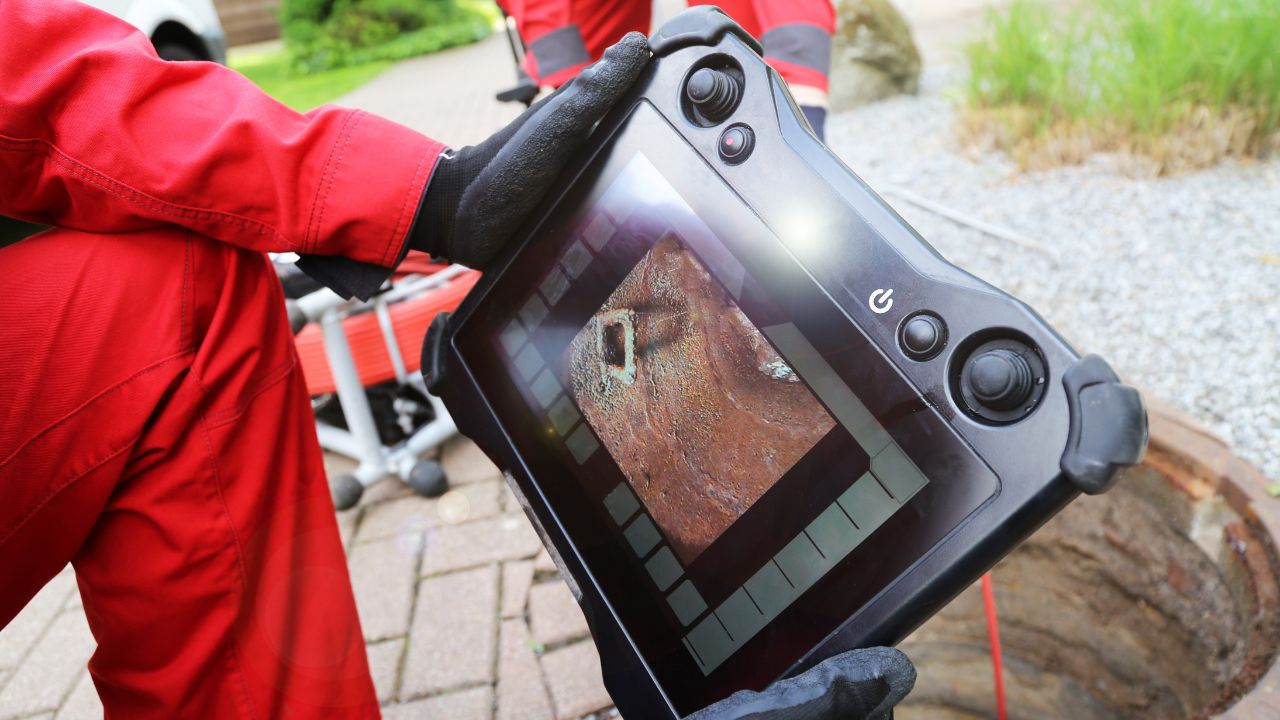
To accurately locate utilities buried deep underground, it is essential to use cutting-edge technology. Tools like Ground-Penetrating Radar (GPR) and electromagnetic locating systems provide real-time, high-resolution images of underground utilities. These technologies allow technicians to detect even the most difficult-to-find utilities, such as fiber optic cables and non-metallic pipes.
Why It Matters:
Advanced technology like electromagnetic induction allows for more precise mapping, preventing the confusion or misidentification of utility locations. Without these technologies, locating buried infrastructures becomes a guessing game, increasing the likelihood of costly damage.
Pre-construction utility mapping is a critical step to ensure a smooth and safe project. Before any excavation begins, it is essential to conduct a comprehensive survey of all utilities in the area. Accurate utility mapping provides a clear view of what’s underground, helping construction teams avoid accidental strikes or disruptions during work.
Why It Matters:
By performing this mapping, you’re ensuring that the construction team is aware of every utility line before work starts, reducing the risk of hitting hidden utilities. This is especially important for complex sites where utilities may not be marked.
No matter how thorough the initial utility locate may seem, it’s always a good idea to double-check utility locations. Cross-checking the utility mapping with multiple methods and technologies can provide an added layer of assurance.
For example, using both electromagnetic locators and GPR can give you a more accurate picture, especially in areas with complex underground utilities.
Why It Matters:
Relying on just one method or marker can result in errors, especially if the utility mapping system doesn’t cover all types of utilities accurately. Double-checking prevents these errors, reducing the likelihood of unforeseen costs during excavation.
The soil composition at a construction site can impact the accuracy of utility locating. Certain soil conditions, such as high mineral content or extremely compacted earth, can affect how well electromagnetic or radar-based equipment works. Being aware of these soil conditions allows utility locators to adjust their methods to account for these factors, ensuring that utilities are detected accurately, even in challenging environments.
Why It Matters:
Soil composition can obscure or distort utility signals, leading to inaccurate readings. By understanding how the soil affects detection equipment, technicians can adjust their approach, increasing the likelihood of finding utilities at the correct depth and location.
Vacuum excavation or utility potholing is a non-invasive method used to expose underground utilities. This technique uses high-pressure air or water to loosen soil, which is then vacuumed away, exposing the utilities without damaging them. It is particularly useful when there’s a need to verify utility locations before excavation begins, offering a safer and more precise method than traditional digging.
Why It Matters:
Vacuum excavation reduces the risk of damaging utilities during potholing, ensuring that the utilities remain intact while providing a clearer view of their exact location.
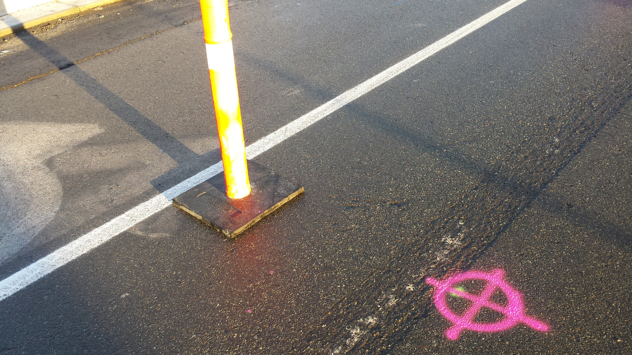
Once utilities have been located, it’s essential to mark them clearly on the ground using paint or flags. These markings provide a visible indication of where utilities lie, helping everyone on the construction site stay informed. Proper markings ensure that the excavation team knows where not to dig, which minimizes the risk of utility strikes and accidents.
Why It Matters:
Clear, precise markings reduce confusion on-site. Without clear markings, the risk of accidental damage or injury increases, leading to costly repairs and project delays.
Utility systems can change over time. New utilities may be installed, or existing ones may be relocated or decommissioned. Therefore, it’s important to keep utility maps up to date to reflect the most current information. Utility providers may not always have the latest data, and outdated maps can lead to dangerous and costly errors.
Why It Matters:
Reliance on outdated maps can result in mistakes during the excavation process, leading to unexpected costs and potential damage to vital infrastructure. Keeping utility maps current ensures that all parties involved have access to the most accurate and reliable information.
For construction projects on private property, it’s essential to work with a private utility locator service. Public utility locators may not be able to accurately detect private utility lines, such as those for residential properties or private facilities.
Why It Matters:
Private utility lines are often more challenging to detect and may not be marked by public utility companies.
Safety should always be the top priority when locating and working around underground utilities. Adhering to established safety protocols ensures that risks are minimized and that workers are properly prepared for the potential hazards associated with utility locating and excavation.
Why It Matters:
Failure to follow safety standards can lead to severe accidents, such as gas leaks or electrical strikes, which not only result in costly repairs but also put the safety of workers at risk.
Avoiding costly mistakes in site preparation starts with reliable utility locating services. If you're looking to protect your project, Bess Utility Solutions offers comprehensive, private utility locating services that ensure accurate mapping and detection of underground utilities. Whether you’re handling excavation, construction, or renovation, their experienced team uses state-of-the-art technology to help you stay on track.
Don’t let an unseen utility derail your project. Contact Bess Utility Solutions today at (408) 988-0101 for expert utility locating services in California and Arizona and ensure the success of your next project.