Hayward, CA
Fresno, CA
Orange, CA
Sacramento, CA
Phoenix, AZ
Every construction project in California begins with a question that carries serious consequences: What is buried beneath the surface? The answer determines whether a project stays on schedule, within budget, and free from incident — or faces costly utility strikes, regulatory setbacks, and work stoppages that no contractor or engineer can afford.
GPR scanning has become the standard of accuracy for subsurface utility detection across California. From large-scale California infrastructure upgrades to commercial site development, Ground Penetrating Radar gives project teams the verified data they need to make informed, confident decisions before a single shovel breaks ground. This guide covers everything California contractors, engineers, and project managers need to know about GPR scanning and its critical role in modern construction.
Key Takeaways
Utility strikes are among the most expensive and dangerous events on a construction site. A single strike on a gas line, high-voltage cable, or pressurized water main can result in work stoppages, emergency repairs, regulatory investigations, injuries, and liability claims that far exceed the cost of a professional utility survey.
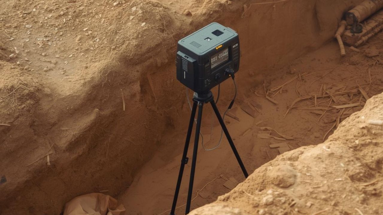
GPR scanning uses high-frequency radio waves to detect and map buried utilities with precision. The signal penetrates the ground and reflects back when it encounters a change in material — a pipe, a conduit, a cable, or a void. The result is a real-time subsurface profile that allows crews to identify utility locations before excavation begins.
In California construction, where underground infrastructure is dense, aging, and often poorly documented, GPR scanning provides a layer of protection that standard 811 locating alone cannot deliver. Private utilities — including conduits, service lines, and irrigation infrastructure — are not covered by 811 and frequently go undetected without a dedicated GPR survey. For any project where excavation depth exceeds a few inches, GPR scanning is a direct investment in utility strikes prevention.
California contractors often ask whether GPR or electromagnetic (EM) locating is the right choice for their project. The honest answer: the two technologies serve different purposes and work best together.
Electromagnetic (EM) utility locating works by detecting metallic utilities — gas lines, copper cables, and steel pipes — that carry or can be induced with an electrical signal. It is fast and effective for locating conductive infrastructure.
GPR scanning, by contrast, detects all subsurface materials that differ in composition from the surrounding soil. This includes:
In GPR vs. EM utility locating, the primary distinction is scope. EM locating is limited to conductive lines with a detectable signal. GPR detects everything that reflects radar energy — metallic or not. For commercial projects where non-metallic utilities are common, relying on EM locating alone creates significant blind spots.
The best practice for California utility projects is a combined approach: EM locating to trace signal-bearing lines, and GPR scanning to capture everything EM misses. This dual-technology survey provides the most complete picture of what lies below.
Urban California presents some of the most congested subsurface environments in the country. Utility mapping in LA and the Bay Area involves aging infrastructure layers built across decades, private utility networks serving dense commercial districts, and active construction zones where multiple utility owners share tight corridors.
Standard locating methods are not sufficient in these environments. The sheer volume of buried lines — telecommunications, electrical, gas, water, storm drain, and fiber — creates conditions where missed detections are almost inevitable without GPR.
GPR scanning produces accurate, georeferenced utility maps that give project teams a clear picture of subsurface conditions. These maps are directly integrated into site plans, CAD drawings, and BIM models, enabling precise design and conflict resolution before construction begins. For California infrastructure upgrades in Los Angeles, San Francisco, San Jose, or any other high-density metro area, GPR utility mapping is a foundational step in professional project planning.
Project delays are one of the most persistent and costly problems in California construction. Utility-related delays — caused by unmarked lines, design conflicts, emergency repairs, or permit holds — account for a significant share of lost time and budget on construction projects statewide.
A professional GPR utility survey reduces this risk at every phase of a project. Here is how GPR directly prevents delay:
The cost of a professional GPR scan is a fraction of the cost of a single day's delay on a mid-size commercial project. For California contractors managing tight timelines and budgets, proactive GPR scanning is a schedule protection strategy, not an optional add-on. Projects that begin with complete subsurface data consistently reach completion faster than those that do not.
GPR utility relocation work is among the most technically demanding applications in subsurface engineering. Before any utility can be relocated, every nearby line must be accurately identified, mapped, and documented. A single mapping error can turn a routine relocation into a multi-day emergency.
California infrastructure upgrades — road widening projects, transit corridor expansions, water system rehabilitations, and fiber network installations — all require utility relocation as part of the broader scope. These projects operate under strict design standards, environmental requirements, and utility owner coordination agreements.
GPR scanning provides the baseline data that makes utility relocation planning possible. It identifies the depth, horizontal position, and material type of existing utilities, giving relocation designers the verified dimensions they need to specify new routes, calculate clearances, and avoid creating new conflicts. Without GPR, relocation designs are based on record drawings that may be decades out of date and may not reflect field conditions accurately.
For any California utility project involving relocation, GPR scanning should be specified at the earliest stage of project planning. The data it produces directly supports utility owner coordination, encroachment permit applications, and final as-built documentation.
GPR accuracy is one of the most common questions engineers ask before specifying a utility survey. The answer depends on site conditions, equipment quality, and the experience of the operator — but modern GPR scanning delivers horizontal accuracy within inches and depth accuracy within a few percent of true depth under typical field conditions.
Factors that affect GPR accuracy in utility detection include:
For California engineers, the key benchmark is ASCE 38-02 compliance. Surveys conducted to ASCE 38-02 Quality Level B standards combine GPR scanning with EM locating and surface geophysical methods to produce the highest level of utility data available short of vacuum excavation. Quality Level A — visual confirmation through potholing — remains the definitive standard for critical conflict resolution. A qualified GPR scanning provider will advise on the appropriate quality level for each project phase.
Commercial developments in CA involve multiple project phases where subsurface data plays a direct role in cost control, design accuracy, and construction safety. GPR scanning adds value at every stage.
For commercial developments in CA, this lifecycle approach to GPR scanning transforms subsurface data from a one-time deliverable into a continuous project asset.
California compliance requirements for subsurface work are among the most detailed in the country. Contractors and project owners face obligations under multiple regulatory frameworks, and accurate utility data is central to satisfying each one.
For any California utility project with permit, environmental, or regulatory obligations, GPR scanning is not just a safety measure, it is a compliance requirement.
When you choose a GPR scanning company for a California utility project, the decision affects every downstream phase of your project. The right provider delivers accurate data, clear documentation, and experienced field personnel. The wrong one delivers uncertainty.
Here are the key criteria to evaluate:
For California contractors and engineers managing commercial, municipal, or infrastructure projects, vetting your GPR provider with these criteria protects your project from the start.
Accurate utility data is the foundation of every successful California construction project. Whether you are planning a commercial development, managing a utility relocation, or preparing for a major infrastructure upgrade, GPR scanning gives your team the subsurface certainty needed to proceed with confidence.
Bess Utility Solutions is a CPUC-certified MBE/DBE subsurface engineering firm with 29 years of experience and over 1,000 satisfied clients across California, Arizona, and Nevada. Our team delivers ASCE 38-02 compliant GPR utility surveys, combined GPR and EM locating, vacuum excavation, and complete subsurface mapping services for commercial, municipal, and infrastructure projects throughout the state.
From utility mapping in LA to Bay Area commercial developments, our regional offices and experienced crews are ready to support your project — on your timeline, to your specifications.
Contact Bess Utility Solutions today to request a consultation or project quote. Reach our team directly or visit our services page to learn how we can support your next California utility project.


