Hayward, CA
Fresno, CA
Orange, CA
Sacramento, CA
Phoenix, AZ
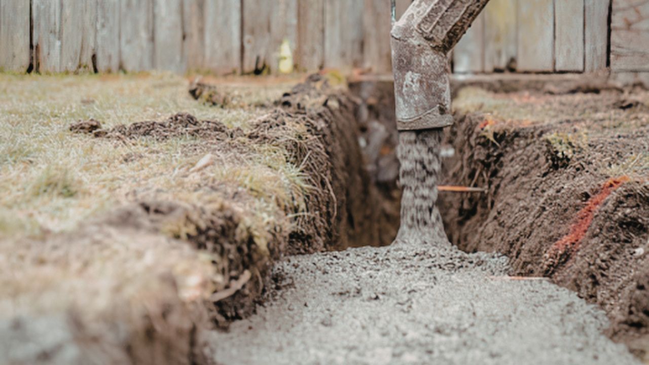
Underground utilities form an invisible infrastructure network essential to modern life, delivering power, water, gas, telecommunications, and wastewater services beneath our feet. Yet this hidden complexity creates significant challenges for construction projects involving trenching and directional drilling. Without accurate knowledge of underground utility locations, excavation work becomes a high-stakes gamble where a single miscalculation can trigger explosions, electrocutions, service outages affecting thousands, and costs reaching tens of thousands of dollars per incident.
The stakes are enormous: over 400 fatalities and 2,000 injuries have occurred since 2000 due to utility strikes, while the United States incurs approximately $30 billion annually from 400,000-800,000 excavation-related damages, translating to 1-2 strikes every minute.
This comprehensive guide examines how utility locating serves as the critical foundation for safe, efficient trenching and directional drilling operations, exploring the technologies, workflows, and best practices that prevent these costly and dangerous incidents.
Key Takeaways
Utility locating identifies underground infrastructure before excavation using electromagnetic (EM) locators and Ground Penetrating Radar (GPR). EM locating detects conductive utilities through three methods: Conductive (direct connection to utility), Inductive (signal placed over suspected path), and Inductive Clamp (signal around utility at access point). GPR emits radio waves (10 MHz to 2.6 GHz) that reflect off buried objects, detecting both metallic and non-metallic utilities based on material density.
The process follows three phases as part of comprehensive pre‑excavation planning. Phase 1 uses EM and GPR surveys to identify and mark utilities according to ASCE 38-02 standards. Phase 2 employs vacuum excavation to create test holes, physically exposing utilities to verify exact positions and depths. Phase 3 implements real-time GPS/GIS tracking (RTK GPS provides centimeter-level accuracy) during active excavation to prevent strikes.
Utility locating prevents 400+ annual fatalities and 2,000+ injuries from strikes, including electrocutions and gas explosions. It avoids $30 billion in annual U.S. costs, with individual strikes averaging $4,000 to $50,000+ in repairs. The practice eliminates service outages affecting hospitals and emergency services, prevents project delays from work stoppages, and avoids OSHA fines ($7,000-$70,000 per incident), state penalties ($500-$10,000), and Pipeline Safety sanctions (up to $257,664 daily). With 400,000-800,000 strikes occurring annually (1-2 per minute), accurate locating is essential for excavation safety and effective risk mitigation.
Accurate utility mapping eliminates rework by preventing excavation in the wrong locations, avoiding costly backfill and re-excavation cycles. Phase 1 data enables precise route planning before breaking ground, while knowing exact utility positions allows continuous excavation without unexpected stops. This understanding supports proactive scheduling for planned utility relocations rather than emergency responses, and reduces tolerance zone areas requiring manual digging.
Projects using comprehensive utility data experience 60-75% fewer change orders. For every $1 spent on utility locating, projects save $4.62 in damage and downtime costs. Preventing strikes eliminates emergency repairs averaging $56,000 per incident plus loss-of-service fees ($10,000 hourly). Since 89% of locating errors stem from incorrect markings or outdated data, proactive locating addresses these issues before excavation begins, optimizing resource allocation and preventing equipment idle time.
| Tool Name | Description | Key Features | Best Use Case |
| Electromagnetic (EM) Locators | Transmitter applies EM signal to utility; receiver detects electromagnetic field | Low frequencies (<1 kHz) for 1-mile distances; Medium frequencies (1-10 kHz) most versatile; 30-40 mA indicates good connection | Tracing conductive utilities over long distances in congested areas |
| Ground Penetrating Radar (GPR) | Emits radar pulses (10 MHz to 2.6 GHz) reflecting off subsurface materials | 100 MHz antenna: 40 ft (wet clay), 100 ft (dry sand); 2000 MHz antenna: 0.5 ft (wet clay), 2 ft (dry sand) | Mapping non-metallic utilities, concrete scanning (18-24 inches), verification in various soils |
| Vacuum Excavation (Potholing) | High-pressure water/air loosens soil; vacuum removes debris | Non-destructive; visual verification; heated water for frozen ground | Pre-trenching verification, exact position confirmation, confined space precision |
| GPS/GIS Integration Systems | RTK GPS provides centimeter-level accuracy; data transmitted to GIS | Instant map updates; 3D/digital mapping; tracking from installation to decommissioning | Utility mapping, historical tracking, emergency response, large-scale projects |
Utility locating prevents cross bores, unintentional intersections where newly installed utilities cross existing sewer or gas lines, creating explosion risks when gas migrates into sewer systems. Potholing at critical crossing points provides visual confirmation of utility positions before bore paths intersect. The CGA DIRT Report identifies locating errors as a leading root cause for HDD damages, with telecommunications being the most frequently damaged facility type.
Accurate locating ensures compliance with minimum clearances: 24-inch separation for perpendicular boring (Miller Pipeline) and 5-foot absolute minimum horizontal separation (Nashville.gov). Comprehensive utility mapping helps operators navigate complex subsurface conditions with varying soil types, geological formations, and dense utility networks, preventing facility operators from striking their own or each other's infrastructure.
Rod-by-rod bore plans based on Phase 1 and Phase 2 utility data enable efficient pilot bore execution with appropriate pitch angles and clearances. Accurate mapping eliminates costly re-drilling from bore path conflicts and reduces drilling fluid management issues like inadvertent surface returns (frac-outs). Precise utility depth data allows optimal bore depth planning (Factor of Safety 1.5-2.0) without excessive overclearance that increases drilling difficulty and costs.
Utility locating employs specialized technologies to detect underground infrastructure before excavation. Electromagnetic (EM) locators use three methods: Conductive Mode connects directly to utilities for strong signals up to 1 mile; Inductive Mode places transmitters over utility paths for rapid area sweeping; Inductive Clamp Mode isolates specific cables in congested environments. Ground Penetrating Radar (GPR) emits radio waves (10 MHz to 2.6 GHz) that reflect off materials, detecting both metallic and non-metallic utilities at depths of 2-100 feet depending on frequency and soil conditions.
Vacuum excavation uses high-pressure water or air to loosen soil, then removes debris via vacuum into 3-16 cubic yard tanks, achieving ASCE Quality Level A accuracy (0.04 feet horizontal, 15 mm vertical). GPS/GIS integration with RTK GPS provides centimeter-level accuracy, transmitting coordinates to databases for instant map updates and 3D digital mapping. GPRS reports 99.8% accuracy by combining these technologies.
| Technology Type | How It Works | Primary Use | Advantages |
| Electromagnetic (EM) - Conductive Mode | Direct electrical connection to utility using cables and clips; ground stake placed far from far-end ground | Tracing individual utilities over long distances; isolating signal to single line | Strong signals up to 1 mile; minimizes coupling to other conductors; works with low frequencies for congested areas |
| Electromagnetic (EM) - Inductive Mode | Transmitter placed on ground over utility path; induces signal without connection | Rapid area sweeping to locate all conductors; initial utility detection | Simple setup; quickly identifies utility presence; works with high frequencies (>100 kHz) for rapid sweeping |
| Electromagnetic (EM) - Inductive Clamp Mode | Clamp encircles utility at access point to induce signal | Isolating specific cables in congested areas; telecommunications and fiber locating | Reduces signal propagation to other conductors; targets specific utilities in multi-line environments |
| Ground Penetrating Radar (GPR) | Radio waves (10 MHz to 2.6 GHz) penetrate ground and reflect off materials | Detecting non-metallic utilities; concrete scanning; utility verification | Detects metallic and non-metallic objects; 2-100 feet depth penetration; provides visual subsurface representation |
| Vacuum Excavation (Hydro/Air) | High-pressure water/air loosens soil; vacuum removes debris into tank (3-16 cubic yards) | Physical utility exposure (potholing); exact position verification; pre-trenching | Non-destructive; ASCE Quality Level A accuracy (0.04 feet horizontal, 15 mm vertical); prevents damage during exposure |
| GPS/GIS Integration | RTK GPS (centimeter-level) or DGPS transmits coordinates to GIS databases | Precise utility mapping; real-time data sharing; long-term tracking | Instant map updates; 3D/digital mapping; improves coordination; reduces outdated map risks |
Effective trenching workflows begin with comprehensive pre-field research: reviewing utility records, contacting companies via One-Call/811, engaging private locators, and using mapping software (ASCE Quality Level D). Multi-phase surveys follow. Phase 1 uses EM and GPR (Quality Level B), Phase 2 employs vacuum excavation (Quality Level A with 0.04 feet horizontal accuracy), and Phase 3 implements real-time monitoring during excavation. Combining multiple technologies achieves comprehensive identification, with documentation including photographed marks, measured positions relative to landmarks, recorded locate dates, and detailed reports.
State-specific validity periods range from 10-48 working days, requiring proactive re-notification before marks expire or environmental factors (weather, ground settling, vegetation, traffic) cause degradation. Projects using comprehensive utility data experience 60-75% fewer change orders. Thorough documentation with measurements to permanent landmarks prevents disputes when marks are obscured by spoils or degraded by weather.
Directional drilling workflows integrate utility data into project timelines with defined phases, activities, and milestones. Direct integration with one-call centers enables real-time 811 ticket processing with live utility company updates and automated alerts. Pre-construction assessments using GPR and EM identify utilities, soil conditions, and obstacles before drilling. Custom geocoders provide accurate dig site notifications, while photo/plan submission ensures complete stakeholder visibility.
Each construction phase requires fresh locates, and comprehensive data minimizes change orders and coordination challenges.
Real-time monitoring during Phase 3 uses RTK GPS (centimeter-level accuracy) to detect unexpected utilities and enable immediate bore path adjustments. Proximity sensors detect utilities within 1-5 feet while electromagnetic tracking monitors drill heads to 100-foot depths. The LDR Excavate™ system integrates GPR into excavator buckets, providing automatic cabin alerts via LDR Visualize™ displays before strikes occur. Platforms analyze risk factors for excavators, facilities, and dig sites, enabling early intervention.
When unmarked utilities appear or mark-versus-actual conflicts arise, real-time systems facilitate immediate work stoppage and re-notification to 811 and utility owners.
Damaging unmarked utilities during trenching has caused 400+ fatalities and 2,000+ injuries since 2000, incidents involving electrocution, gas explosions, fires, and toxic leaks. Financial penalties include OSHA violations ($7,000-$70,000 per incident), state fines ($500-$10,000), and Pipeline Safety penalties (up to $257,664 daily). Service disruptions affect hospitals, emergency call centers, and critical infrastructure, while entire projects halt for inspector, utility company, and safety team responses, creating idle crews and cascading delays.
Contractors bore responsibility for over 75% of utility strike damages in 2021, including 83% of natural gas-related and 92% of telecom-related damages in 2023, leading to prolonged litigation. These consequences are largely preventable, 76% of utility strikes are avoidable through proper locating procedures.
Professional utility locating ensures OSHA compliance with 29 CFR Part 1926 Subpart P (excavation requirements) and 1926.1408 (power line clearances: 10 feet for up to 50 kV, 15 feet for 50-200 kV, 20 feet for 200-350 kV). It eliminates catastrophic injury potential from live wires, gas lines, and pressurized pipes, particularly critical given HDD's limited visibility compared to open trenches. Meeting state-specific 811 requirements and maintaining tolerance zones (typically 18-24 inches from utility edges requiring hand digging or vacuum excavation) prevents regulatory violations.
Direct repair costs average $4,000 per incident, with total costs ranging from $ 5,000 to $50,000+ that include property damage and medical expenses. Indirect costs (customer dissatisfaction, brand damage, legal consequences) multiply direct costs by 29 times. The U.S. incurs $30 billion annually from 400,000-800,000 strikes (1-2 per minute).
Insurance claims and premiums increase while productivity losses compound, longer delays make schedule recovery harder, reducing productivity across jobs and impacting subcontractors. With 76% of strikes preventable through proper locating, the economic case for comprehensive utility identification is overwhelming.
Artificial Intelligence and Machine Learning are transforming utility locating through enhanced predictive analysis using historical data patterns and faster real-time decision-making. Integrated monitoring platforms now combine 811 ticket management, GPS/GIS technologies (RTK GPS, DGPS), automated alerts, and risk factor analysis. Multi-frequency GPR systems like Quantum Imager operate across 10 MHz to 2.6 GHz ranges to balance depth penetration and resolution across soil conditions.
Automated detection systems such as LDR Excavate™ embed GPR directly into excavator buckets, providing cabin alerts without off-site expert analysis. Proximity sensors detect utilities within 1-5 feet, while electromagnetic tracking monitors drill heads to 100-foot depths with continuous position data.
AI analyzes historical strike data (400,000-800,000 annual incidents) to identify high-risk patterns and predict conflict zones. Machine learning processes live data from EM locators, GPR, and GPS to automatically adjust accuracy based on changing conditions, reducing interpretation time from hours to seconds. AI compares Phase 1 (EM/GPR surveys) with Phase 2 (potholing) data to identify discrepancies requiring additional investigation.
These systems address the 89% of locating errors caused by locator mistakes, incorrect markings, or outdated data by cross-referencing multiple sources. AI automatically selects optimal EM frequencies, low (<1 kHz) for congested areas, high (10-100 kHz) for small diameter lines, adapting in real-time to site conditions.
| Integration Type | Benefit | Example |
| Real-Time Data Exchange (811 Integration) | Direct integration into every one-call center; immediate ticket receipt and response; live utility company updates | Irth Solutions platform with automated alerts and remote monitoring, reduces manual entry throughout the ticket lifecycle |
| GPS/GIS Mapping Integration | Instant map updates as utilities are located; centimeter-level RTK GPS accuracy; enables 3D/digital mapping | GPS coordinates are transmitted to GIS databases immediately; blends survey data, record maps, and scans into shareable maps |
| In-Equipment GPR Systems | Automatic detection and alerts before strikes; eliminates separate locating steps; works across soil types | LDR Excavate™ buckets (1-3.5 to 30-40 ton, 18"-36" widths) with embedded GPR and LDR Visualize™ cabin display |
| Proximity Alert Systems | Automatic warnings within 1-5 feet of utilities; reduces operator cognitive load; prevents accidental strikes | Subsite HDD equipment with integrated sensors alerting operators before drill head reaches utility |
| Electromagnetic Tracking Integration | Continuous drill head monitoring to 100 feet depth; real-time bore path verification; immediate deviation detection | Tracking devices integrated with drilling rig controls for automatic path corrections; maintains 24-inch minimum clearance |
| Vacuum Excavation Coordination | Mobile field team access; real-time excavator-locator communication; state-specific law compliance | Smart forms for monitoring visits created from excavation tickets; follow-up scheduling; damage data collection |
Underground utility locating services prevent the 400+ fatalities and 2,000+ injuries that have occurred since 2000 from utility strikes, protecting crews and the public from electrocution, explosions, and toxic leaks. For every $1 spent on locating, projects save $4.62 in damage and downtime, preventing the $30 billion annual U.S. cost from 400,000-800,000 strikes. The practice ensures compliance with OSHA requirements (29 CFR Part 1926 Subpart P), state 811 laws, and power line safety standards (minimum clearances of 10-20 feet). Projects using comprehensive utility data experience 60-75% fewer change orders, eliminating work stoppages and cascading delays.
Utility locating protects critical infrastructure, preventing service outages that affect hospitals, emergency services, and communities. It prevents OSHA violations ($7,000-$70,000 per incident), state fines ($500-$10,000), Pipeline Safety penalties (up to $257,664 daily), and prolonged litigation. The multi-phase approach, Phase 1 EM/GPR surveys (Quality Level B), Phase 2 potholing (Quality Level A with 0.04 feet horizontal accuracy), and Phase 3 real-time monitoring, achieves 99.8% accuracy.
Combining electromagnetic locating, GPR (2-100 feet penetration), and vacuum excavation provides reliable results across applications. With 76% of strikes avoidable through proper procedures, prioritizing utility locating directly addresses the root causes of excavation-related damage, enabling the safe execution of complex directional drilling and trenching in congested corridors.
Contact Bess Utility Solutions today to protect your next project with comprehensive utility locating services that prevent costly strikes and ensure regulatory compliance.


