Hayward, CA
Fresno, CA
Orange, CA
Sacramento, CA
Phoenix, AZ
Ground-penetrating radar scanning has become essential infrastructure for reducing utility-strike risk across California's congested corridors. Selecting a qualified GPR service provider requires evaluating technology capabilities, workflow integration, compliance standards, and operational responsiveness rather than comparing equipment specifications alone.
The underground utility mapping market reached USD 1.75 billion in 2026 and projects 11.18% annual growth through 2034. California buyers operate within the most mature North American market for private utility locating, where damage incidents, regulatory oversight, and documentation expectations drive service differentiation.
Key Takeaways
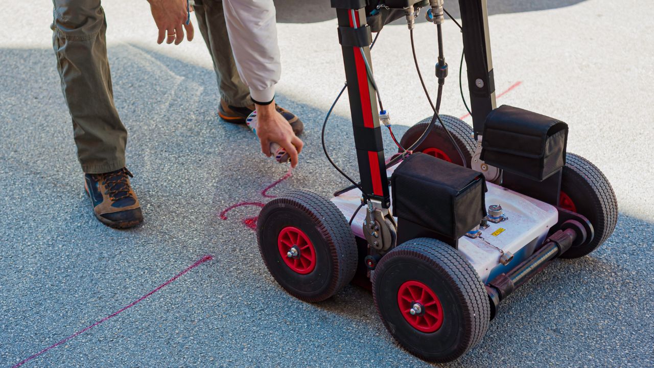
Ground-penetrating radar detects subsurface features by transmitting electromagnetic pulses and recording reflections from buried objects and soil boundaries. The technology behind underground utility locating relies on analyzing signal return times and amplitudes to map utility positions before excavation begins.
GPR plays a critical role in identifying unknown utilities, nonconductive lines, and abandoned infrastructure that electromagnetic methods cannot trace. Private utility locating using GPR reduces strike risk by revealing subsurface conditions that as-built records often miss or misrepresent.
GPR antennas emit high-frequency radio waves that penetrate soil and reflect back when encountering density contrasts or buried objects. Signal interpretation requires understanding how ground conditions affect wave propagation and return strength.
Conductive clays and saturated soils degrade GPR signals through attenuation, reducing effective penetration depth and target clarity. A 400 MHz survey in a Spanish sewerage project successfully rerouted the sewer layout away from cavity evidence, demonstrating how proper frequency selection and interpretation support design decisions.
Electromagnetic locating excels at tracing conductive metallic utilities using direct connection or induction methods. EM equipment provides fast designation for known utility networks where records indicate metallic infrastructure.
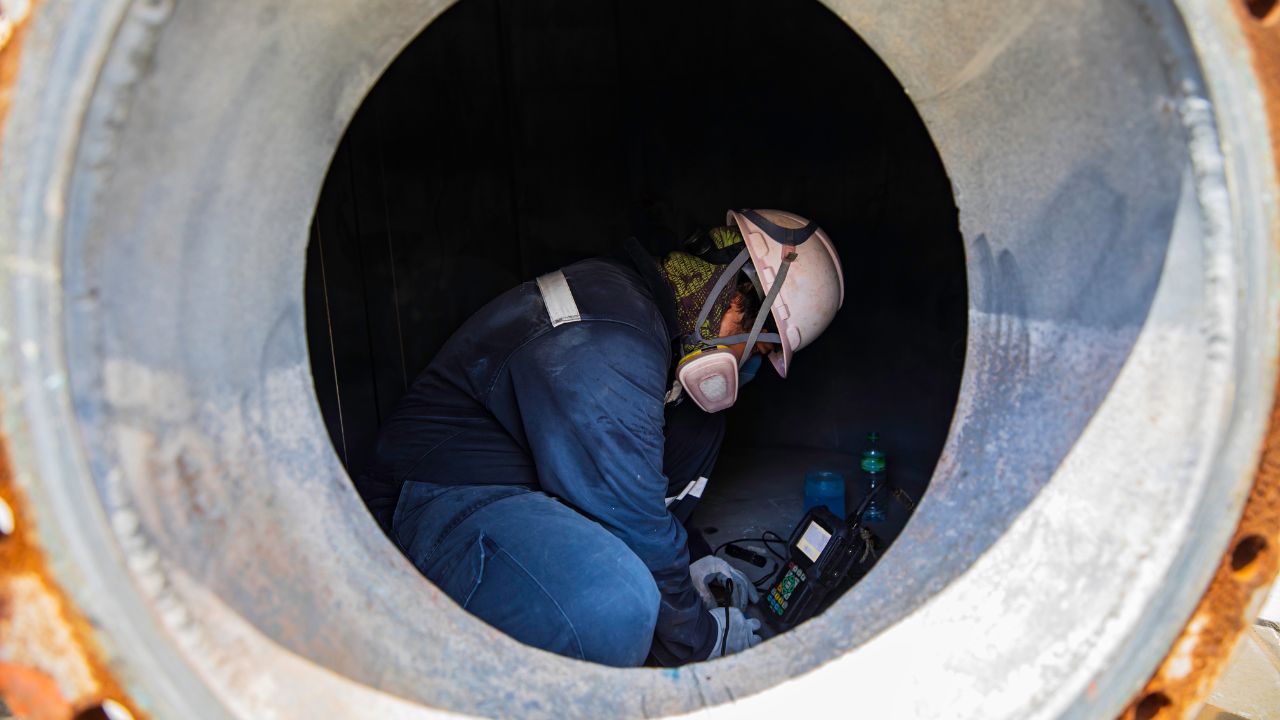
EM performs poorly on nonconductive lines and complex abandoned networks where signal interference creates false positives. Vacuum excavation confirms depth and horizontal position through nondestructive exposure, but operates more slowly than remote scanning methods.
Utility scanning and private utility locating represent an estimated 44% share of commercial demand for GPR-led subsurface services. Civil construction and subsurface utility engineering support account for approximately 24% of buyer activity.
Environmental and site assessment applications hold roughly 12% share, while concrete scanning and structural imaging capture 11%. Emerging GIS, LiDAR, and digital-twin integration represent the fastest-growing premium segment at approximately 9% estimated share.
Accurate utility mapping prevents excavation damage, design conflicts, and schedule delays that drive total project costs beyond initial budgets. The importance of utility locating in construction projects becomes clear when comparing strike consequences against verification costs.
Inaccurate subsurface data forces redesign work, creates liability exposure, and disrupts traffic or service continuity in urban corridors. PG&E reported 1,247 utility-damage incidents in 2024 with average direct repair costs of USD 3,500 per strike.
Strike risk from inaccurate locating creates safety hazards, service interruptions, and financial liability for contractors and project owners. Excavation damage triggers redesign requirements when conflicts emerge after construction mobilization begins.
Project delays compound when utility strikes halt work pending investigation, repair, and clearance from affected operators. California's Underground Safety Board logged 1,383 notifications and complaints in 2024, reflecting persistent challenges in utility-coordination workflows.
California's 94.2% urban population concentration creates intense utility congestion in metropolitan corridors compared to the 80.0% national average. Los Angeles requires potholing for utilities within three feet of excavation, establishing verification standards stricter than basic remote sensing.
Only 5.8% of Californians live in rural areas, concentrating commercial demand in the Bay Area, Los Angeles, the Inland Empire, and the Central Valley markets. The Underground Safety Board received 1,383 notifications and complaints in 2024, with damage reports rising 17.5% year over year.
Quality Level A verification uses nondestructive exposure to provide the highest confidence in utility position and depth measurements. Quality Level B remote sensing delivers horizontal positioning sufficient for most design-phase coordination when combined with survey control.
Stakeholders require better than 100 mm tolerance for utility locations, typically to 3 m depth and occasionally to 5 m. Subsurface utility engineering benefits include reduced change orders, improved bid accuracy, and defensible documentation when conflicts arise.
Provider selection for a California utility project should prioritize accuracy, turnaround capability, and documentation quality over equipment specifications alone. Professional excavators cite inaccurate locating as the core weakness in 78% of survey responses, while 56% identify response-time issues.
Wait time for clearance affects 52% of excavators, and incomplete locate responses create a 38% probability of schedule disruption. These performance gaps explain why buyers increasingly evaluate utility locating services based on workflow discipline rather than only technology claims.
Accuracy failures cause the majority of professional excavator frustration, with 78% identifying inaccurate locating as the primary process weakness. Response time and clearance delays affect 56% and 52% of excavators, respectively, creating compounding schedule pressure.
Professional excavators face a 38% chance of being unable to begin work as scheduled due to incomplete locate responses. Demand volatility creates bottlenecks by midweek because excavators submit 30% more 811 tickets on Mondays than on Fridays.
GIS-enabled documentation supports repeatable asset management and programmatic infrastructure tracking across multiple project phases. Planning and design tickets help owners coordinate utility work before construction mobilization begins.
Electronic positive response systems provide auditable confirmation that utility owners have reviewed and cleared excavation areas. Verification workflows ensure that field findings match deliverable accuracy claims, with 99% of professional excavators familiar with local 811 requirements.
Technology sophistication matters when it improves accuracy, reduces uncertainty, or accelerates decision-making in complex subsurface conditions. Cost becomes a secondary factor after accuracy, timing, and documentation quality are satisfied.
Buyers should evaluate whether advanced technology translates into better field execution and usable deliverables rather than only hardware specifications. Price differences between budget and premium providers reflect service breadth, crew capability, and documentation standards more than equipment alone.
Service pricing in California ranges from USD 250-600 per hour for basic private locating to USD 3,360-4,500+ per day for integrated workflows. Budget-tier providers focus on field designation with limited documentation, while premium firms deliver survey-grade mapping and GIS-ready outputs.
Mid-range offerings typically include GPR and electromagnetic locating with CAD deliverables priced at USD 1,800-2,800 per day. Service differentiation reflects crew capability, technology integration, and documentation quality rather than only hourly rates or equipment inventory.
Budget-tier services operate at USD 250-600 per hour, providing basic GPR or electromagnetic locating with field markings and sketches. Sentry Mapping publishes a USD 250 per hour rate for private utility locating using GPR-led workflows.
Mid-range providers charge USD 1,800-2,800 per day for combined GPR and EM services with utility plans and moderate documentation. Subsurface Utility Engineers LLC lists an all-inclusive USD 3,360 per day rate covering two technicians, 3D GPR, GPS data collection, and GIS modeling.
Mid-range providers deliver CAD utility plans with basic quality control suitable for general contractor coordination and permit submissions. Premium providers integrate survey control, potholing coordination, GIS compatibility, and engineering-grade reporting for design-phase decision-making.
Workflow differences appear in method selection, verification protocols, and documentation depth rather than only equipment specifications. Premium services justify higher day rates by reducing change-order risk and supporting repeatable asset-management programs.
Retainer and annual callout models provide faster dispatch and better system familiarity for recurring owner needs across campuses or utility networks. One-off task orders offer procurement flexibility for occasional users without long-term commitments.
Scalability depends on crew availability, geographic coverage, and dispatch capacity during demand spikes created by weekly excavation patterns. Providers with regional office networks mobilize faster than single-location firms when California utility project schedules compress.
Evaluating GPR providers requires understanding method integration, quality-level matching, and deliverable usability rather than comparing technology specifications alone. Strong providers explain how they select methods based on soil conditions, utility types, and project risk rather than applying uniform workflows.
Best practices include defining project risk class, matching scope to appropriate quality levels, and verifying that deliverables meet engineering and owner standards. The importance of utility mapping in construction increases when design decisions depend on subsurface intelligence accuracy.
GPR represented 38% of the underground utility mapping technology share in 2024, while electromagnetic locating held an estimated 32% share. Vacuum excavation and potholing account for approximately 18%, with GIS, LiDAR, and digital capture representing 12%.
Method integration delivers better results because GPR detects nonconductive features while electromagnetic locating traces metallic utilities efficiently. Single-method dependence creates blind spots where soil conditions or utility types exceed individual technology capabilities.
The project risk class determines whether Quality Level B remote sensing or Quality Level A verification provides sufficient confidence for design decisions. High-consequence projects justify verification through potholing when strike costs or schedule impacts exceed verification expense.
Providers should explain their method stack, expected accuracy, and uncertainty ranges rather than offering vague confidence claims. Buyers must evaluate whether deliverables and documentation match local agency expectations and design-phase coordination requirements.
CAD and GIS-ready formats support engineering coordination, permit submissions, and repeatable asset management across project lifecycle phases. GPS GIS mapping integration in underground utility locating enables programmatic infrastructure tracking and digital-twin applications.
Utility legends, conflict logs, QA notes, and photographic documentation provide auditable evidence when field conditions differ from record drawings. Electronic deliverables reduce transcription errors and support long-term institutional knowledge better than paper-only outputs.
California's regulatory environment combines state-level oversight through the Underground Safety Board with fragmented municipal standards across counties and cities. Market conditions reflect high excavation activity, volatile locate demand, and increasing digitalization expectations among progressive agencies.
Provider capabilities vary based on whether firms understand local agency requirements, traffic-control protocols, and potholing specifications. Santa Clara County demonstrates advanced GIS adoption, while Los Angeles enforces explicit potholing requirements within three-foot excavation buffers.
California lacks a universal public-works standard across agencies, but more than 70% of respondents reported standard lists of special provisions. Documentation expectations vary by jurisdiction, with progressive counties requiring GIS compatibility and electronic positive response systems.
Compliance requirements include 811 coordination, traffic control during field operations, and deliverable formats matching local agency specifications. Utility locating in Alameda, CA, exemplifies regional service adaptation to county-specific standards and urban corridor complexity.
Weekly excavation patterns create demand volatility because excavators submit approximately 30% more 811 tickets on Mondays than on Fridays. Midweek bottlenecks develop when locate volume spikes exceed provider capacity and coordination timelines compress.
Seasonal construction activity peaks during favorable weather months, further concentrating demand when project schedules align across multiple owners. Providers with scalable crew networks and rapid mobilization capability maintain service levels during peak periods better than constrained firms.
Urban corridors in Los Angeles, the Bay Area, Sacramento, and San Diego drive the majority of California GPR demand due to utility congestion. Rural areas represent only 5.8% of the state population, limiting service frequency outside agricultural water infrastructure and linear utility corridors.
PG&E covers Northern and Central California with extensive transmission and distribution networks requiring coordination during third-party excavation. Regional adoption varies by county GIS maturity, with Santa Clara County demonstrating more advanced digital asset management than many peer jurisdictions.
Emerging trends include GIS and digital-twin integration, premium pricing for data-rich deliverables, and market differentiation between basic locate vendors and intelligence-focused firms. Technology adoption follows owner maturity and internal system capabilities rather than uniform industry-wide deployment.
Market growth projections show the underground utility mapping market reaching USD 2.97 billion by 2031 from a 2026 base of USD 1.75 billion. California providers adapting to digitalization expectations and workflow integration will capture the fastest-growing premium segments.
GIS and LiDAR integration depends on strong field-locating foundations that provide accurate subsurface data for spatial database population. Digital-twin applications require repeatable data collection protocols and standardized deliverable formats across project phases.
Premium pricing for GIS integration reflects additional processing, survey control, and software expertise beyond basic field designation. Benefits depend on owner maturity and internal systems, with advanced agencies extracting greater value than organizations lacking asset-management infrastructure.
The underground utility mapping market reached USD 1.75 billion in 2026 and projects growth to USD 4.08 billion by 2034 at 11.18% CAGR. Five-year projections estimate the market at USD 2.97 billion by 2031, reflecting sustained infrastructure investment and digitalization momentum.
The GPR market grew from USD 491.98 million in 2026 toward a projected USD 882.67 million by 2034 at 7.58% CAGR. How GPR helps identify leaks and voids demonstrates expanding application breadth beyond traditional utility designation into condition assessment and structural integrity work.
Professional excavators represent the largest and most risk-sensitive buyer segment, with 73% identifying process weaknesses despite 99% 811 familiarity. Commercial demand drives service differentiation because professionals require accuracy and timing standards exceeding basic homeowner needs.
Residential demand exists but operates at smaller ticket sizes, with 74% of American homeowners planning outdoor digging projects annually. More than 10 million homeowners planned to dig without contacting 811, and 46% would not call first, indicating persistent awareness gaps in residential segments.
Successful company selection depends on matching provider capabilities to project risk, documentation requirements, and schedule constraints rather than seeking the lowest hourly rate. The right GPR scanning company combines technical accuracy, method integration, compliance awareness, and operational responsiveness in California's demanding urban corridors.
Buyers should evaluate providers using a five-step framework: define project risk class, match scope to quality levels, require method-stack explanations, assess deliverable formats, and verify operational scalability. Premium providers justify higher pricing through reduced change-order risk, faster mobilization, and engineering-grade documentation that supports long-term asset management.
Bess Utility Solutions delivers ASCE 38-02 compliant subsurface intelligence across California's most complex utility corridors. Our integrated approach combines GPR, electromagnetic locating, vacuum excavation, and GIS mapping to provide decision-grade data when accuracy matters most.
Choosing the right GPR scanning company protects your project from costly strikes, delays, and compliance failures. Bess Utility Solutions brings 29 years of field experience, ASCE 38-02 compliant processes, and an integrated suite of services — including GPR, electromagnetic locating, vacuum excavation, and GIS mapping — to California's most demanding utility corridors.
Whether you're a civil engineer designing around complex subsurface conditions or a contractor who needs accurate, on-time results, our CPUC-certified team delivers decision-grade data you can build on. Contact Bess Utility Solutions today to discuss your project requirements and receive a detailed service proposal.
Disclaimer:
Every utility project is unique, and pricing can vary depending on location, complexity, and service needs. The prices mentioned are estimates only. For the most accurate and competitive quote, we recommend contacting Bess Utility Solutions for a personalized assessment.