BESS Utility Solutions Logo
Hayward, CA
(408) 988-0101
Fresno, CA
(559) 272-1375
Orange, CA
(909) 510-5535
Sacramento, CA
(510) 461-1792
Phoenix, AZ
(602) 633-7200

The Future of Potholing Utilities in Construction: Trends to Watch in 2025

March 14, 2025 / Written by: Bess Utility Solutions

March 14, 2025
Written by: Bess Utility Solutions

Key Takeaways

  • Ground Penetrating Radar improves accuracy in locating underground utilities, minimizing unnecessary excavation.
  • GPR enhances job site safety by reducing the risk of damaging critical infrastructure like gas lines and fiber optic cables.
  • Combining GPR with vacuum excavation speeds up potholing processes, reducing delays and project costs.
  • GPR supports utility maintenance by detecting underground infrastructure issues before they become major problems.
  • Using GPR ensures compliance with environmental and safety regulations, helping contractors avoid legal complications.

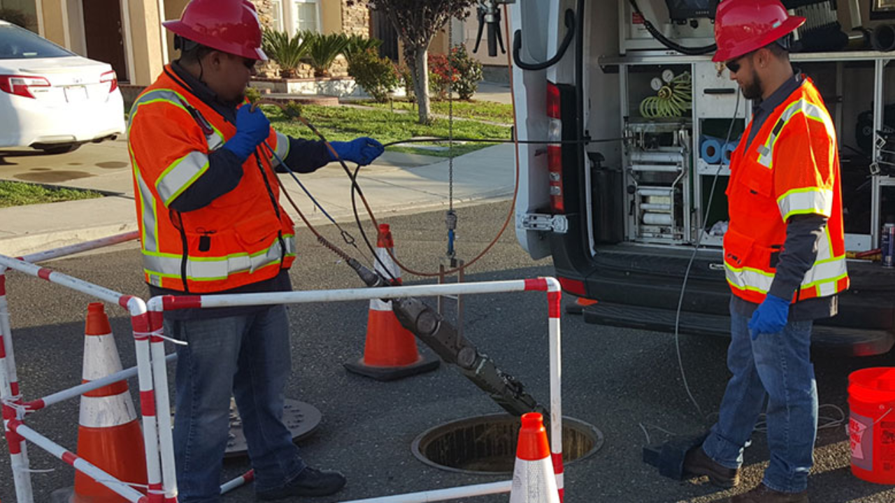
Ground Penetrating Radar (GPR) plays a crucial role in modern utility locating services. It provides a non-invasive method to detect underground utilities before excavation begins. This technology helps reduce the risk of accidental damage and ensures a safer, more efficient potholing process.

Potholing for utilities requires precision and reliability. GPR enhances this by offering accurate subsurface imaging, helping field crews identify utility lines without unnecessary digging. This prevents costly downtime and minimizes disruptions to ongoing construction projects. 

Additionally, GPR helps in mapping the depth and orientation of underground infrastructure, which is crucial for determining the best excavation approach. It detects variations in soil composition and highlights potential hazards, allowing for better planning and risk assessment before any digging begins.    

The Advantages of GPR in Potholing for Underground Utilities

1. Improved Accuracy in Utility Mapping

  • GPR helps determine the exact location of underground utility lines, reducing the need for excessive excavation.
  • It provides detailed data on underground facilities, making it easier for utility companies to update their records and utility maps.
  • This accuracy prevents costly errors that can arise from outdated or incomplete utility records.
  • GPR’s ability to differentiate between various materials, such as concrete, metal, and plastic, ensures comprehensive detection of all underground utilities.

2. Risk Reduction and Safety Enhancement

  • Using GPR before vacuum excavation or potholing utilities reduces the risk of damaging critical infrastructure like gas lines, water lines, and fiber optic cables.
  • The technology enhances job site safety by offering visual confirmation of buried utilities before any excavation begins.
  • It allows for pre-excavation safety assessments, ensuring that workers operate in an environment with minimal risk.
  • By reducing reliance on traditional excavation methods, GPR minimizes disruptions to nearby properties and traffic, making it an ideal solution for urban and high-traffic areas.

3. Efficiency in the Excavation Processstate

  • Traditional excavation methods can be time-consuming and disruptive. GPR speeds up the potholing process by pinpointing utilities more efficiently.
  • The integration of GPR with vacuum excavation technology ensures minimal risk and precise digging, making it the preferred method in the construction industry.
  • This efficiency translates into cost savings for construction projects by reducing delays and minimizing the need for rework.
  • GPR’s ability to function in various environmental conditions ensures reliable results, even in difficult terrains like dry soil, rocky ground, or frozen surfaces. 

4. Compatibility with Advanced Utility Locating Technologies

  • GPR works seamlessly with surveying, utility mapping and concrete scanning, providing a comprehensive understanding of underground infrastructure.
  • This state-of-the-art technology enhances subsurface utility engineering by offering insights into utility locations in actual field conditions.
  • When combined with 3D laser scanning and drone photogrammetry, GPR delivers highly detailed underground utility maps that help streamline construction planning.
  • The integration of artificial intelligence in GPR data analysis further enhances accuracy, allowing for more efficient interpretation of underground structures.

The Role of GPR in Complex Excavation Environments

Excavation projects in dense urban areas or near critical infrastructure require extreme caution. GPR plays a vital role in these environments by detecting underground anomalies that may not be recorded in existing utility maps. It helps identify abandoned utility lines, voids, and geological variations that could impact excavation safety.

GPR is particularly useful in areas with historical infrastructure where underground utilities have been added over time without proper documentation. By providing real-time feedback, GPR ensures that excavation teams can adapt their approach as needed, preventing costly delays and legal complications associated with accidental damage.              

Potholing Services: A Smarter Approach with GPR

GPR, combined with vacuum excavation, offers a smarter and safer way to locate underground utilities. This efficient process ensures that unknown utilities are identified before they become a hazard. By using specialized equipment, construction crews can mitigate the risk of damage and avoid costly downtime.

Additionally, GPR is effective in challenging soil conditions, including dry soil, rocky soil, and frozen ground. This adaptability makes it a reliable solution for various excavation projects, from small-scale utility locating to large-scale infrastructure upgrades.

Optimizing Utility Maintenance with GPR

Beyond excavation, GPR plays a crucial role in ongoing utility maintenance. Regular GPR scans allow utility agencies to monitor underground infrastructure for signs of deterioration, leaks, or shifting utility lines. This proactive approach prevents unexpected failures and extends the lifespan of essential public and private utility networks.

By integrating GPR into routine maintenance programs, utility owners can reduce service interruptions, improve response times to underground issues, and enhance overall infrastructure reliability. This preventive strategy is essential for managing large-scale infrastructure upgrade projects effectively.

GPR’s Role in Environmental and Regulatory Compliance

Excavation and utility locating must comply with various environmental and safety regulations. GPR helps contractors and utility companies adhere to these regulations by offering a non-destructive method for identifying underground utilities. It eliminates the need for excessive digging, reducing soil disturbance and minimizing environmental impact.

Regulatory agencies often require accurate underground utility mapping before issuing excavation permits. GPR provides the necessary data to streamline compliance, helping contractors avoid legal complications and project delays. Additionally, it aids in ensuring that utility locating is performed according to best practices, enhancing overall safety and sustainability.

Secure Your Project with Expert Utility Locating Services

Don’t leave your excavation projects to chance. Bess Utility Solutions combines cutting-edge GPR technology with expert potholing techniques to deliver accurate utility locating services. Our commitment to excellence ensures the safety of workers, construction teams, and underground infrastructure.                                                                                                   

Contact us today for a free quote at (408) 988-0101 and experience the benefits of precision-driven utility locating.

Contact Us

We prioritize clear communication and reliable solutions to meet your specific requirements. Get in touch with us today, and let's work together to ensure the safety and efficiency of your projects.
© 2025 Bess Utility Solutions. All Rights Reserved.