Hayward, CA
Fresno, CA
Orange, CA
Sacramento, CA
Phoenix, AZ
Key Takeaways
In construction and engineering, understanding the conditions beneath the surface is essential. Geotechnical investigations reveal important information about soil quality, hidden voids, and the stability of foundations.
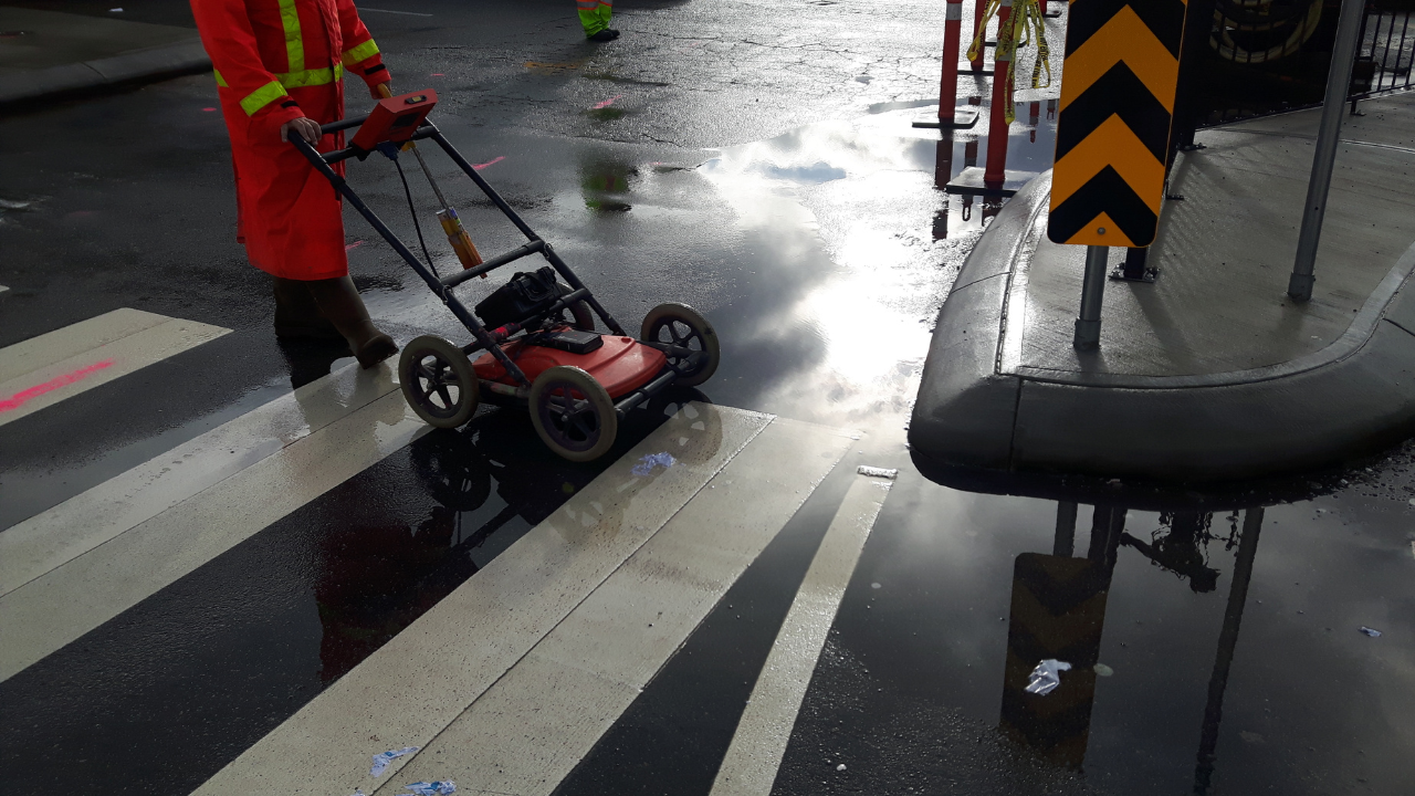
For these investigations, Ground Penetrating Radar (GPR) has become an invaluable tool. GPR provides a non-invasive way to assess subsurface conditions, helping geotechnical engineers gather accurate data without digging or drilling.
GPR sends radar waves into the ground and records the reflections to show what lies beneath. These reflections reveal details about soil layers, water content, and any voids or gaps that may impact the stability of a construction site. With GPR, engineers can see potential issues before they become problems, allowing for safer and more effective building practices.
We will explore how GPR is used in geotechnical investigations to assess soil conditions, locate sinkholes, and ensure stable foundations. We’ll look at the advantages of GPR in identifying subsurface conditions and how it supports safer, more informed construction projects.
GPR is widely used in geotechnical engineering for many reasons. It provides detailed images of what’s beneath the surface, making it easier to understand soil composition, water levels, and other important factors. Here are some key ways GPR benefits geotechnical investigations:
Soil conditions vary from site to site and can impact a project’s stability. GPR helps geotechnical engineers assess the quality and type of soil, showing whether it is sandy, rocky, or clay-based.
For instance, in areas with loose or sandy soil, additional stabilization may be needed before building can begin. By understanding soil conditions early, engineers can make informed decisions to support a stable foundation.
Sinkholes and underground voids pose serious risks in construction. These empty spaces can collapse, causing buildings or roads to shift or fail. Underground utility locating services use GPR to detect these voids by showing areas where there is a sudden drop in density.
For example, a sinkhole forming under a potential building site would show up as a gap on the GPR scan. Engineers can then address these voids before construction begins, ensuring a safer foundation.
Knowing the water table level is crucial for projects involving deep foundations. A high water table can make the ground unstable and affect the building’s foundation. GPR helps identify water-rich areas and shows the depth of the water table.
For projects requiring basement levels or underground utilities, this information is vital for preventing future water-related issues.
Bedrock provides a solid base for construction, but its depth varies by location. GPR can determine the depth of the bedrock, which is important for projects requiring a strong, stable foundation.
For example, skyscrapers and large structures need to be anchored deep into the bedrock. GPR scans show where this layer begins, helping engineers plan accordingly.
Different soil layers can have varied effects on a building’s stability. GPR maps these layers, showing how they are distributed.
For instance, if there’s a layer of loose soil above a dense layer, it may impact how the foundation is constructed. By mapping these layers, engineers can design foundations that adapt to each site’s unique conditions.
One of the main uses of GPR in geotechnical investigations is to ensure stable foundations. By analyzing soil composition, bedrock depth, and any underground voids, GPR helps engineers design safe foundations.
For example, if a construction site has unstable soil, the foundation may need special support, such as pilings driven into deeper, stable soil.
Before digging or drilling, it’s essential to know if there are any buried utilities like gas lines or water pipes. GPR detects these obstacles by showing their shape and position.
This prevents accidental hits that could delay a project or cause safety hazards. Utility locating services using GPR provide critical data, allowing construction teams to avoid these areas.
For road construction, GPR is used to assess the condition of existing pavement and underlying soil. By identifying weak spots or voids under the road, engineers can reinforce these areas before adding new pavement layers. This helps extend the life of roads and ensures safer driving conditions.
In addition to soil analysis, GPR is also used to scan concrete. Concrete scanning with GPR identifies rebar, cables, and voids within the concrete, which is important for ensuring structural integrity.
For example, during renovations, GPR can locate areas where concrete has weakened, allowing engineers to strengthen those spots before continuing with construction.
GPR is also useful in environmental studies, especially when assessing land for potential contamination or changes in soil composition.
By analyzing the subsurface, GPR can detect changes in soil density that may indicate contamination. This information helps environmental scientists determine if further testing or cleanup is needed.
Bess Utility Solutions offers expert Ground Penetrating Radar (GPR) services for safe, efficient geotechnical investigations.
Our team knows how vital accurate underground data is for stable construction, utility locating, and concrete scanning. Using advanced GPR technology, we provide precise, non-invasive mapping to help engineers and construction teams make smart decisions.
Whether you need to check soil conditions, find hidden voids, or secure a strong foundation, Bess Utility Solutions is ready to help. Contact us to see how our GPR services can support your project.
 Bess Utility Solutions


